Hiking to Sørlandshagen

Difficulté 2
Værøya
2 to 3 hrs
1.3 km
50 m
23 m
Vest-Lofoten - 1:50 000
Until March
Type de rando :
Go back
Visibilité du sentier :
Bonne
Départ/Arrivée :
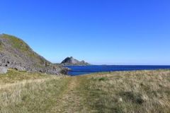
From the port of Værøy, take the 'Nordland' direction. Once you're at the hamlet, keep on Route 791 and then on the dirt track that prolongs the road to the end. Park near the toilets. The trail starts just behind the beach of Heimretussen.
Point(s) GPS :
Starting point: N67° 40.205' E12° 39.181', parking lot 
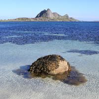
North side of the beach (Hagmolla): N67° 40.018' E12° 39.496' 
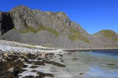
South side of the beach (Hagesletta): N67° 39.743' E12° 38.973' Cape of Nupsneset: N67° 39.058' E12° 39.138'

Description


This big bay, which stretches out on a north-south axis, has a vast stony beach right under impressive granite cliffs. Between the beach and the cliffs there is extended an area of dunes, covered by a meadow with very low vegetation. Traces of human inhabitants from the stone age to the Middle Ages have been found on the southern part of the beach (Hagsletta). More recently the area around the bay was used as a sheep pasture until the 1960’s. The spot is both wild and easy to get to.


More information about this hike...

Cover EN ptYou can read the detailed description of this hike (as well as 59 other hike descriptions), enjoy hundreds of photos, maps and practical information on the paper guidebook Hiking the LOFOTEN ISLANDS.
You'll find the guidebook on logo amazon en, as well as at the following bookstores, for 24,07£ (not including shipping).

Order on Amazon


Accessibilité

Accessible to dogs, Family friendly

Diaporama