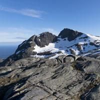
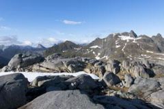
The Støvla peak (824m) majestically overlooks the small port of Sørvågen. With its amphitheatre-like rock formation backing onto a dark granite cliff it resembles a giant throne. The peak is surrounded by lakes and cliffs and appears inaccessible to hikers. If you ask the locals whether there is a trail to the peak, they will all give you different answers and be a little vague about which route to follow. There is to our knowledge only two tracks to climb to the top without climbing equipment. We chose to present you the passage crossing the mountain of Snaufjellet , which is longer but allows access to the top without waiting for it to be completely cleared of snow. This walk is long and complex, which explains why so few people bother.
There is a second path, by a rocky ledge on the east slope of the mountain (south of Lake Fjerddalsvatnet ) . Warning, this second path presents risks as long as the snow has not completely disappeared from the northern face of the mountain.
More information about this hike...