The start of 2019 marks the sixth year of Hiking-lofoten's existence, and we thought it was time to update the “consultation statistics” (yep, they haven’t been updated since 2015 ;-)).
The analysis of this anonymous data provided by Google Analytics gives us - in addition to the satisfaction of looking at these nice figures - a better understanding of what visitors come to look for. In short it allows us to improve the content of the website.
Of course, we prefer direct contact with users telling us what they would like to see on the website or what isn't so useful. So, let's say it again: do not hesitate to contact us by email to share your suggestions, so we can make new improvements.
In any case, we believe that it is normal and interesting for users to be informed about Hiking-Lofoten's functioning and its evolution.
Users
Visits / sessions data
YEAR | 2014 | 2015 | 2016 | 2017 | 2018 |
Users1 | 24.808 | 57.851 | 96.972 | 135.734 | 161.424 |
User progress compared to the previous year |
| +133,19% | +67,62% | +38,62% | +18,93% |
New users2 | 24.686 | 57.353 | 96.041 | 133.342 | 159.059 |
New user progress compared to the previous year |
| +132,33% | +67,46% | +38,84% | +19,29% |
Sessions3 | 43.470 | 103.129 | 169.663 | 227.320 | 266.334 |
Sessions progress compared to the previous year |
| +137,24% | +64,52% | +33,98% | +17,16% |
Number of sessions per user4 | 1,75 | 1,78 | 1,75 | 1,67 | 1,65 |
Average number of sessions per user compared to the previous year |
| +1,74% | -1,85% | -3,34% | -1,48% |
Page views5 | 483.172 | 1.010.543 | 1.420.037 | 1.398.071 | 1.507.407 |
Page view progress compared to the previous year |
| +109,15% | +40,52% | -1,55% | +7,82% |
Pages/session6 | 11,12 | 9,8 | 8,37 | 6,15 | 5,66 |
Average number of pages view per session compared to the previous year |
| -11,84% | -14,58% | -26,52% | -7,97% |
Average session duration7
| 7,03 | 6,48 | 6,18 | 5,04 | 3,24 |
The average length of a session in minutes compared to the previous year |
| -3,47% | -7,41% | -19,52% | -32,8% |
Bounce rate8 | 2,75% | 1,35% | 2,47% | 10,72% | 4,48% |
Average bounce rate compared to the previous year (this number should be as low as possible) |
| -50,87% | +82,53% | +334,48% | -58,22% |
Detailed users data for 2018
Demographics
Age range
Ranking of site users by age group
18-24 years | 13,18% |
25-34 years | 36,86% |
35-44 years | 18,59% |
45-54 years | 13,5% |
55-64 years | 10,85% |
65 years + | 7,02% |
Geo
Countries from which site users connect to hiking-lofoten
France | 26,6% |
Germany | 20,57% |
Norway | 13,74% |
Swiss | 5,86% |
United-States | 5,43% |
United-Kingdom | 2,99% |
Belgium | 2,77% |
Finland | 2,50% |
Austria | 2,29% |
Sweden | 2,15% |
Other countries | 15,1% |
Language
User's browser language
French | 33,87% |
german | 28 ,94% |
English | 20,02% |
Finnish | 1,46% |
Italian | 1,18% |
Other languages | 14,53% |
Definitions
(1) Users : Users who have initiated at least one session during the date range.
(2) Nwe user : The number of first-time users during the selected date range.
(3) Session : A session is the period time a user is actively engaged with your website, app, etc. All usage data (Screen Views, Events, Ecommerce, etc.) is associated with a session.
(4) Number of sessions per user : The average number of Sessions per user.
(5) Pages views : Pageviews is the total number of pages viewed. Repeated views of a single page are counted.
(6) Pages / session : Pages/Session (Average Page Depth) is the average number of pages viewed during a session. Repeated views of a single page are counted.
(7) Average session duration : The average length of a Session.
(8) Bounce rate: The percentage of single-page sessions in which there was no interaction with the page. A bounced session has a duration of 0 seconds.
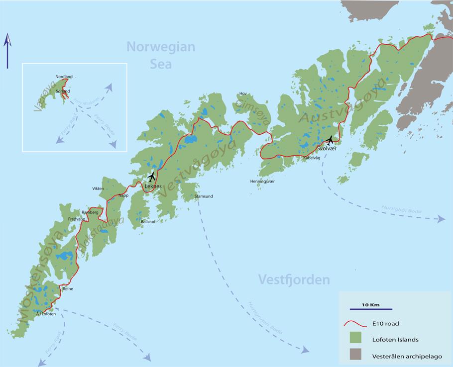
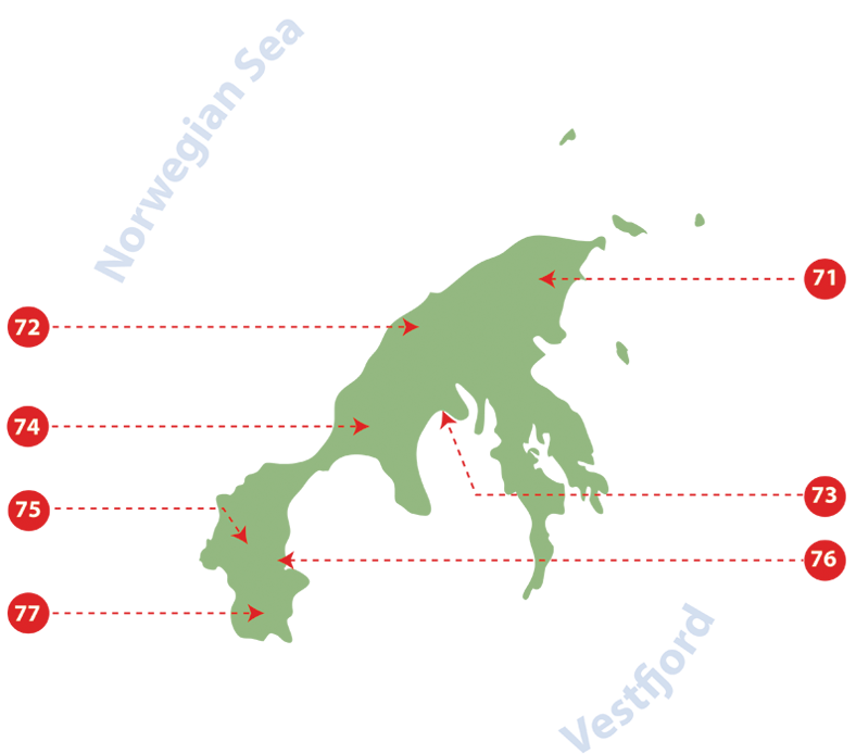
The long crossing from north to south on the Lofoten Islands

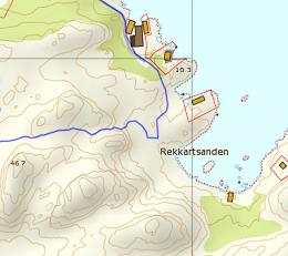
The MS Fjordskyss boat(http://www.reinefjorden.no), which is suposed to link Reine to Vindstad, Kjerkfjord and Forsfjord has some time "dificulties" to stop at Forsfjord power station.
Since it is also possible to walk from Vindstad to Forsfjord, we have decide to give you the GPX track for this part (only in french), in case the boat driver is too tired to drive you to Forsfjord that day ;-) |
Since Rando-Lofoten was founded a certain number of visitors have told us they would be interested in a trekking itinerary that crosses the archipelago from one end to the other. Crossing a region from north to south or east to west often enables travellers to set themselves a goal when faced with the unknown. But over and above the physical or psychological challenge we believe it is important to remember that hiking is above all about discovery and enjoyment.
In drawing up the following itinerary we gave ourselves the following goals:
- To avoid missing the most iconic places on the islands
- To avoid tarmacked sections of road wherever possible
- To hike as often as possible within easy reach of supply points (shops, petrol stations) to avoid having to carry an enormous rucksack!
Lastly, this itinerary is not the only possible one. Many of the hikes on the Rando-Lofoten site do not lie directly on the route of this crossing but are easily accessible if you branch off, provided you have the time and inclination. The duration/distance of the stages we propose here is only a suggestion based on a reasonable level of fitness and decent weather, but it may be adapted to your own criteria. If you decide to camp you can pitch your tent virtually anywhere on the islands, provided of course that you comply with the regulations in force. Although water supplies are to be found everywhere at all stages, you will find relatively few food stores on the route. We have made a note of all the food supply points on this itinerary (shops, restaurants, petrol stations) that existed in 2014. To avoid disappointment, once you get there you should, however, check the opening times of these supply points when you leave each stage for the next.
Remember that Rando-Lofoten is above all a participatory site and any suggestions to improve this itinerary, either in the forum or by email, are welcome.
Enjoy your hike!
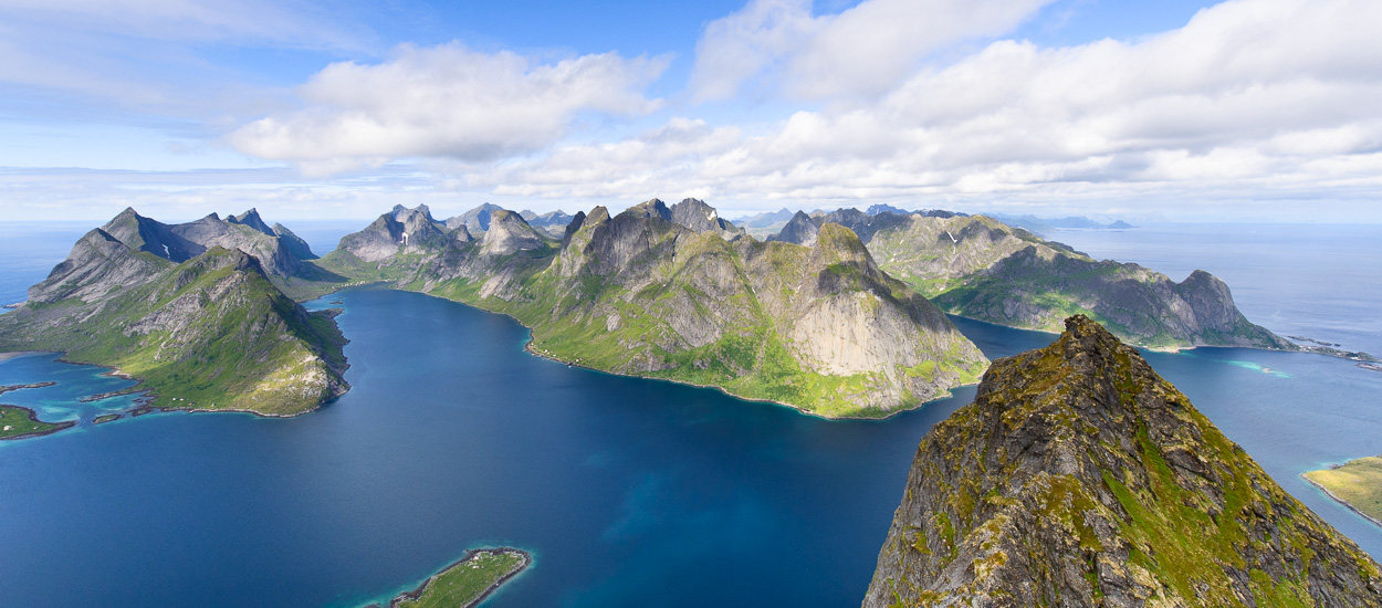
Crossing the Lofoten Islands in 11 stages
160km and 9,193 m uphill
Island of Austvågøya
Stage No. 1 – Delp/Sandsletta
 | Departure: hamlet of Delp (N68 24.065 E14 30.171)
Arrival: hamlet of Sandsletta (N68 20.163 E14 29.907)
Distance: 12.8 km
Duration of hike: 5 h
Uphill: 927 m
Camping: possible everywhere
Campsite near the point of arrival: Sandsletta campsite (N68 20.163 E14 29.907) inexpensive and good service.
Supply point(s): Sandsletta campsite (small convenience store + restaurant).
Note: It is a good idea to do your shopping in Svolvaer. |
Stage No. 2 – Sandsletta/Svolvaer
 | Departure: hamlet of Sandsletta (N68 20.163 E14 29.907)
Arrival: near Svolvær (N68 14.646 E14 32.094)
Distance: 13 km
Duration of hike: 6 h
Uphill: 697 m
Camping: possible everywhere
Campsite near the point of arrival: Lofoten Feriesenter (N68 14.879 E14 32.939) high prices and poor service.
Supply point(s): Sandsletta campsite, small convenience store + restaurant. Svolvær, several shopping centres and shops in the town centre - N68 14.045 E14 33.690. Caution: there is nowhere to buy supplies in any of the next three stages.
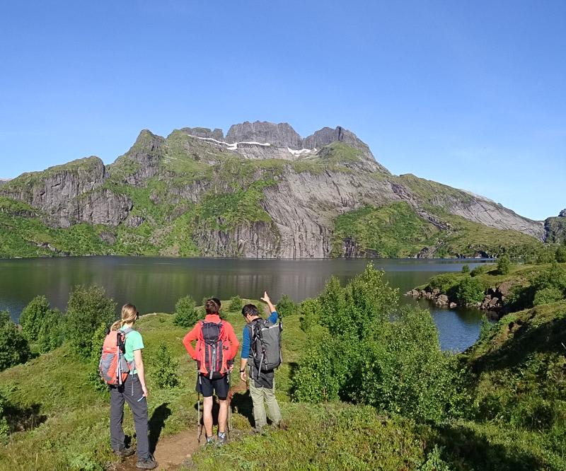
Nearby hikes: Rundfjellet (Only for registerd users). |
Stage No. 3 – Svolvaer/Kleppstad
 | Departure: near Svolvaer (N68 14.646 E14 32.094)
Arrival: hamlet of Kleppstad (N68 15.554 E14 16.666)
Distance: 17.3 km
Duration of hike: 8 h
Uphill: 644 m
Camping: possible everywhere
Campsite near the point of arrival: None
Supply point(s): None
Nearby hikes:Tjeldbergtinden (Only for registerd users). |
Island of Vestvågøya
Stage No. 4 – Vikjorda/Lake of Store Krenggårsvatnet
| Note: in order to get to the starting point of this stage you have to cross 14 km of tarmacked road that cannot be avoided of which 6.3 km on the main E10 road and 6.5 km on the minor 815 road. It’s not much fun walking on the road and we recommend you try to hitchhike, particularly along the stretch of the E10 road that is quite busy in summer and therefore potentially dangerous. The 6.5 km stretch along the 815, from the second bridge, is far less busy and may therefore be walked. |
 | Departure: hamlet of Vikjorda (N68 13.631 E14 04.605)
Arrival: Lake of Store Krenggårsvatnet (N68 11.219 E13 45.426)
Distance: 19.5 km (not including the section of tarmacked road)
Duration of hike: 7 h (not including the section of tarmacked road)
Uphill: 1,392 m
Camping: possible everywhere but there is a well-equipped cabin, which is freely accessible, near the lake of Store Krenggårsvatnet (or Store Kringlebotnsvatnet depending on which map you consult)
Campsite near the point of arrival: None
Supply point(s): None
Nearby hikes:Vikjordstinden, Trolldalstinden, Blåtinden, Kartstaven (Only for registerd users). |
Stage No. 5 - Lake of Store Krenggårsvatnet/town centre of Leknes
| Note: This is the final stage on the island of Vestvågøya. As it is relatively short it’s a good idea to buy supplies in Leknes (the largest town on the islands) and find means of transport to cross the second stretch of the road that is not hiker-friendly but connects Leknes to the village of Napp on the island of Flakstadøya. This stretch of the E10 covers a distance of 13.5 km and includes a section of highway and a tunnel under the sea that is prohibited to pedestrians! There are two ways of getting to the village of Napp: either hitchhiking or by bus. The bus leaves from near the Statoil petrol station in the town centre (N68 08.911 E13 36.783). When you reach Napp take the little road on the left and walk approximately 800 m to the wharf south of the port. The trail begins from the wharf (N68 07.744 E13 26.278) and you will soon find a number of quiet spots to camp along the coast. Special Notice: Thanks to an unfriendly farmer who did not appreciate to see a few hikers’ crossing his property we have decided to propose you a new trail for stage 5. The last part of the route has been modified and it is now better, although a bit longer, then the previous one ;-)
The part starting from Hagskaret pass has a nice and easy trail all the way to the road 997 (Fygle – Ramsvika)
|
 | Departure: Lake of Store Krenggårsvatnet (N68 11.219 E13 45.426)
Arrival: Rema 100 super market, Leknes (N68 08.684 E13 37.265)
Distance: 11 km
Duration of hike: 3.30 h
Uphill: 221 m
Camping: complicated around the town of Leknes but anywhere you like from the village of Napp.
Campsite near the point of arrival: None
Supply point(s): town of Leknes, the last real supply point for the next two stages!
Nearby hikes:Justadtinden, Slettheia, Guratinden (Only for registerd users). |
Island of Flakstadøya
Stage No. 6 – hamlet of Napp/hamlet of Nusfjord

| Departure: car park at the end of the wharf in Napp (N68 07.744 E13 26.278)
Arrival: hamlet of Nusfjord (N68 02.056 E13 20.891)
Distance: 17.6 km
Duration of hike: 8 h
Uphill: 953 m
Campsite: continue for roughly 800 m after the village of Nusfjord, you’ll find a number of spots to camp at the beginning of the trail to Nesland (N68 01.765 E13 20.952).
Campsite near the point of arrival: None
Supply point(s): small shop (very expensive) in the village of Nusfjord open only in the high season. A café/restaurant is also open in the high season near the wharfs (expensive).
Nearby hikes:Stornappstinden, Store Klauva, Hestraeva, Nesheia (Only for registerd users). |
Stage No. 7 – hamlet of Nusfjord/Village of Ramberg
| Note: accessing the village of Ramberg adds approximately 3 km (round trip) to the route to the south of the Lofoten. But Ramberg is also the only place you can buy supplies for the next two stages. The little Bunnpris shopping centre in the centre of the village is not only reasonably priced for Norway, it also offers a wide range of goods. |
 | Departure: near the hamlet of Nusfjord (N68 01.765 E13 20.952)
Arrival: near the village of Ramberg (N68 04.469 E13 12.468)
Distance: 19.7 km
Duration of hike: 7 h
Uphill: 446 m
Camping: if you want to camp during this stage, leave Ramberg and follow the E10 towards Fredvang. You will find sites before the bridges where you can pitch your tent.
Campsite near the point of arrival: Ramberg Gjestegård campsite (N68 05.567 E13 13.967)
Supply point(s): Bunnpris shopping centre (open all year round - N68 05.377 E13 13.692). You will also find a little café (Friisgården) in the centre of the village as well as a perfectly acceptable café/restaurant at the campsite in Ramberg. Caution, there is nowhere to buy supplies in the next two stages.
Nearby hikes:Tonsåsheia (Only for registerd users). |
Island of Moskenesøya
Stage No. 8 – Near Ramberg/Selfjord Bay
| Note: You have to cross the bridges leading to Fredvang at the beginning of this stage and take a section of tarmacked road for approximately 4 km (including the bridges). There is not usually much traffic on this road. |

| Departure: near the village of Ramberg (N68 04.469 E13 12.468)
Arrival: Selfjord Bay (N68 02.189 E13 04.309)
Distance: 17.5 km
Duration of hike: 7 h
Uphill: 902 m
Camping: possible everywhere
Campsite near the point of arrival: None
Supply point(s): None
Nearby hikes:Volandstinden, Moltinden, Kitinden (Only for registerd users). |
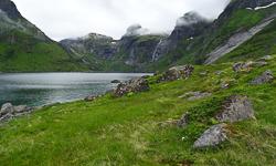
Stage No. 9 – Selfjord Bay / Forsfjorden Fjord
| Note: Caution this stage involves crossing the fjord of Reine by boat from Kjerkfjorden to Forsfjorden (approximately 20 min). The boat only does the crossing once a day during the high season, usually leaving Kjerkfjorden around 3 p.m. It is important to enquire about departure times beforehand at www.reinefjorden.no. You should also be aware that Forsfjorden is only a request stop and you should make it clear this is your destination when you get into the boat. |
")
| Departure: Selfjorden Bay (N68 02.189 E13 04.309)
Arrival: Little hill behind the Forsfjorden hydroelectric plant (N67 56.030 E12 58.770)
Distance: 11 km
Duration of hike: 5 h
Uphill: 1,165 m
Camping: possible everywhere. Ideally, to see the fine view and be able to camp on dry, flat ground you should climb to the top of the hill (448 m) between the lakes of Krokvatnet and Tennesvatnet. This campsite is approximately a 45-minute walk from the landing-stage at Tennesvatnet.
Campsite near the point of arrival: None
Supply point(s): None
Nearby hikes:Tverrfjellet (Only for registerd users). |
Stage No. 10 – Hill 448 above Forsfjorden / Å-i-Lofoten (on the shores of the lake of Agvatnet)
| Note: This stage takes you across the top of Munkan from where you can enjoy the magnificent view. Starting from your campsite at point 448 m you can also make a slight detour by climbing Hermanndalstinden, the highest peak on the island of Moskenesøya. If you take this option you should allow for approximately 3½ hours more walking. (See the guide-book for this hike). This stage includes part of the E10 road which is hiker-friendly between Sørvågen and Å-i-Lofoten (2.5 km). |
")
| Departure: Hill 448m behind the Forsfjorden hydroelectric plant (N67 56.030 E12 58.770)
Arrival: near the lake of Agvatnet (N67 53.211 E12 57.873)
Distance: 13.2 km
Duration of hike: 6 h
Uphill: 794 m
Camping: possible everywhere on the shores of the lake of Ågvatnet
Campsite near the point of arrival: None
Supply point(s): Two small supermarkets in the village of Sørvågen (N67 53.392 E13 01.242 - N67 53.482 E13 01.552) as well as a café/restaurant (Maren Anna - N67 53.376 E13 01.447) on the wharf. There is a little convenience store in the village of Å-i-Lofoten (very expensive! - N67 52.781 E12 59.036) and a café/restaurant near the landing-stage that is open during the high season.
Nearby hikes:Hermandalstinden, Støvla, Tindstinden (Only for registerd users). |
Stage No. 11 – Lake of Ågvatnet / Bay of Stokkvika / village of Å-i-Lofoten
")
| Departure: near the lake of Ågvatnet – right bank (N67 53.211 E12 57.873)
Arrival: near the village of Å-i-Lofoten (N67 52.635 E12 58.677)
Distance: 12.5 km
Duration of hike: 6 h
Uphill: 1,117 m
Camping: possible everywhere
Campsite near the point of arrival: None
Supply point(s): A-i-Lofoten |
How to get to the start of stages 1, 2, 6 and 11?
Watch out: In Norway like elsewhere, bus schedules can be modified. It is important that you check the information given her, before jumping into the first bus!
All bus schedule for Lofoten and Vesterålen can be found here
On the website: 177norland.no
By calling: 177 (only from Norway)
Get to the starting point of “stage 1”: DelpIf you don’t want to try your luck with hitchhiking you can take the following buses Take the line 18-749 from Svolvær in direction of Liland, stop at Jordness Kryss (20 min). Wait there and take the bus 18-733 in direction of Laukvik, then stop at Straumsnes Vest. Walk until the start of the hike. |
| - Outside holiday periods: from 01/02 to 19/06 (excepted weeks 8 and 12) and from 22/08 to 30/01 (excepted week 52) Line 18-749
Svolvær sentrum / Jordnes kryss Line 18-733
Jordnes kryss / Straumsnes vest |
| - During summer holidays: from 20/06 to 21/08 Ligne 18-733
Svolvær sentrum / Delp |
Get to the starting point of “stage 4”: VikjordaThere again, if you don’t feel for hitchhiking, take the following buses from Svolvaer 1) If you are ready to walk a few kilometers on an asphalted road with little traffic (from Sundklall to Vikjorda), take the line 18-741 from Svolvaer center in the direction of Leknes and ask the bus driver to drop you just after Sundklakk’s bridge. Then walk along the paved road 815 until the hamlet of Vikjorda |
| - Outside holiday periods: from 01/02 to 19/06 (excepted weeks 8 and 12) and from 22/08 to 30/01 (excepted week 52)
Ligne 18-741 (Winter - Autumn)
Svolvær sentrum / Sundklall |
| -During summer holidays: from 20/06 to 21/08 Line 18-741
Svolvær sentrum / Sundklakk |
| 2) If you wish to take the bus all the way to Vikjorda you need to go though Leknes. Take the line 18-741 to Leknes, then the line 18-763 from Leknes to Vikjorda. In this case you will have to wait 1h40 in Leknes between the two buses. This is a good opportunity to do some shopping ;-) |
| - Outside holiday periods: from 01/02 to 19/06 (excepted weeks 8 and 12) and from 22/08 to 30/01 (excepted week 52) Ligne 18-741 (Winter - Autumn)
Svolvær sentrum / Leknes sentrum (1h40 waiting time) Line 18-763
Leknes sentrum / Vikjorda |
| -During summer holidays: from 20/06 to 21/08 Line 18-741
Svolvær sentrum / Leknes sentrum Line 18-763
Leknes sentrum / Vikjorda : (No bus during the weekend) |
Get to the starting point of “stage 6”: Napp (from Leknes)There again, if you don’t feel for hitchhiking, take the following bus from Leknes. Notice: You cannot walk from Leknes to Napp, since you will have to cross an under sea tunnel which is not advisable for pedestrian. So take the line 18-742 or 23-760 in direction of Å-i-Lofoten and get out of the bus at Napp Ost. |
| - Outside holiday’s period: from 01/02 to 19/06 (excepted weeks 8 and 12) and from 22/08 to 30/01 (excepted week 52)
Line 18-742
Leknes sentrum / Napp Ost Line 23-760
Leknes sentrum / Napp Ost |
| - Summer holidays: from 20/06 to 21/08
Line 18-742
Leknes sentrum / Napp Ost Line 23-760
Leknes sentrum / Napp Ost |
Leave the Lofoten after the “stage 11”: Å-i-Lofoten |
How to reach the ferry at Moskenes You can walk along the road E10 (about 5 km) or take the bus 18-742 which goes to Leknes and stop at Moskenes harbor. |
How to reach Leknes (airport) Take the line 18-742 or 23-760 from Å-i-Lofoten to Leknes sentrum, then walk to the airport (10 min) or take a taxi. |
How to reach Stamsund (Costal express – Hurtigruten) Take the line 18-742 or 23-760 from Å-i-Lofoten to Leknes sentrum, then change bus at Leknes and take line 18-767 to Stamsund. Stop at “Stamsund kai” |
An Athletic Trek in the South of the Lofoten Islands

3 or 4 days – leave : Sørvågen / arrive : Reine
Total distance : 39km, Height difference +/- 3600m, maximum altitude 1029m
Season : July, August and September
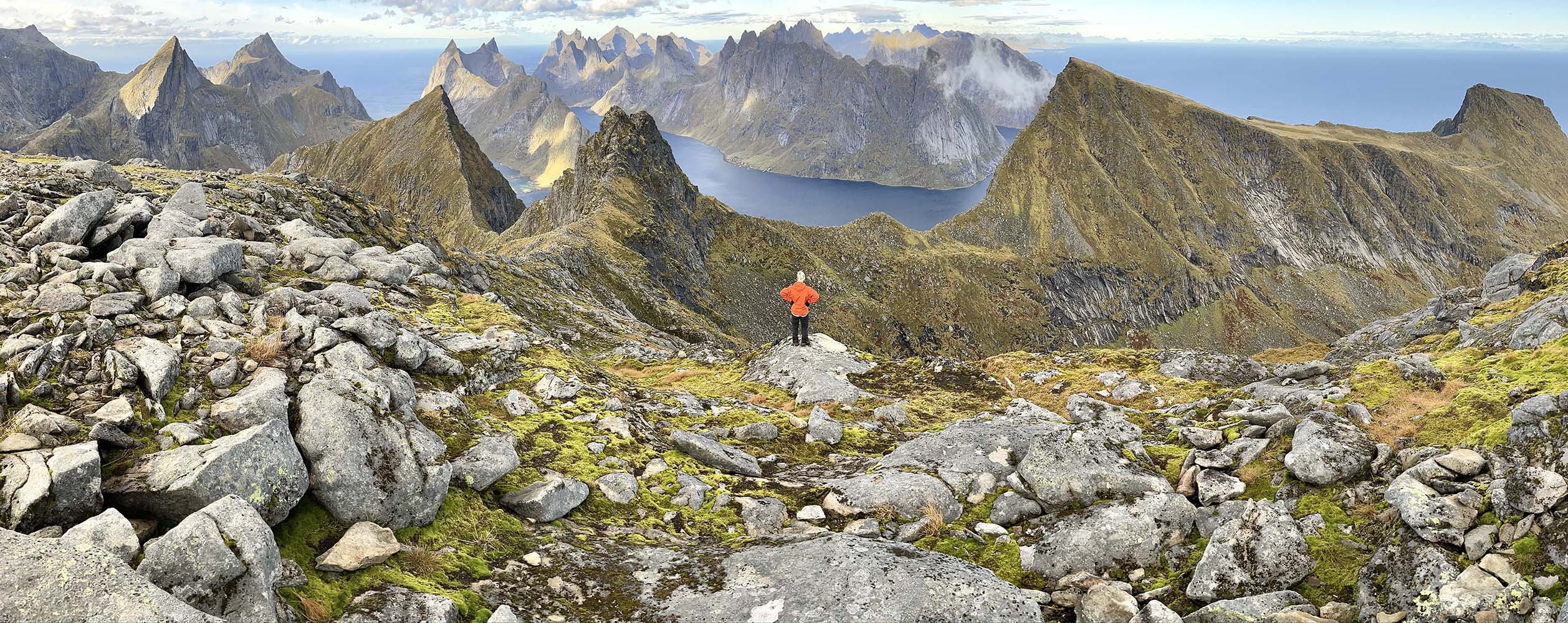
This very athletic trek combines the most beautiful summits of Moskenesøya Island into one big hike. It’s intended for people who don’t have the time to take longer treks (like the great hike across the Lofotens), but who like physical exertion in high-mountain landscapes. You should have some mountain experience and a good sense of direction, for aside from the height difference and distances you’ll have to cross, most of the hike will be off-trail, over wild, uneven terrain.
It is preferable to make this trek in 4 days to get the most out of the places you’ll hike through, but if you’re in a hurry, it’s possible to get back to the village of Reine in the afternoon of day 3. To do that, you’ll have to get to Vinstad before the last ferry leaves at 3:25 PM (see schedules here). However, as Bunes Beach is a magnificent spot to bivouac and admire the midnight sun, we think you’d do better to take your time and spend the third night in this beautiful place...
…
NOTE: There are no refueling points beyond Sorvagen, you must start this trek with 3 to 4 days of food (Or a good fishing rod ;-)
Complete trek map (below)
Stage n°1 – From Sørvagen to Krokvatnet Lake
Don’t be fooled by the distance of this leg of the hike: it goes over the summit of Støvla and it’s the hardest part of the itinerary, along with Stage No. 2. Only do it if the snow has totally disappeared from the summit. Some passages of the ascent go along extremely slanted slopes over Fjerddalsvatnet Lake and when there’s snow, the passage can be dangerous—in fact, impossible. The ascent to the summit as well as the way back down to the lake pass through screes and highly uneven terrain where a GPS may be necessary. But what a reward, when you get to the top of Støvla and its 360° panorama over the south of the archipelago!
When you get back down, you’ll find several places to bivouac between Lakes Krokvatnet and Tennesvatnet. The point we suggest here is a little rounded promontory that gives you a lovely view over the fjord of Forsfjorden. From there, you’ll be ready to set out on the ascent of Herrmannsdalstinden the next morning.
")
Leave : Sørvågen (N67° 53.474’ E13° 00.608’)
Arrive : hill 440m, between the lake of Krokvatnet and Tennesvatnet (N67°56.013’ E12°58.738’)
Distance : 11km
Time of trip : 6 to 7h
Height difference : +1276m/-789m
Maximum altitude : 824m
Bivouac : possible everywhere
Place to get water : all along the trail
Places to get food : Sørvågen (Joker, Matkroken)
Note : Some passages are dangerous if snowed (you will find snow until july normaly). A gps device is very useful especially in the downhill
Other nearby hikes : Tindstinden, Munkan
Stage n°2 – Hermannsdalstinden Summit (1,029 m / 3,376 ft) and the valley of Hermannsdalsvatnet
This is the longest leg of the trek—and the most extraordinary in terms of the landscapes you will hike through. You’ll first reach the highest summit of Moskenesøya Island (Hermannsdalstinden – 1,029 m / 3,376 ft); then a wild, not very accessible valley that reaches the west coast of the island. Just as for the Støvla summit, it is not advisable to venture onto the summit of Hermannsdalstinden if it is still covered with snow: there’s a risk of avalanches and falling rocks. It is important to manage your effort carefully during this leg of the hike, for once you reach the summit, you still have a long way to go. The climb back down to the fjord of Forsfjorden and the trail along the fjord are both quite challenging and you still have to go through a second pass (500 m / 1,640 ft of height difference) to reach the valley of Hermannsdalen. As you walk along Hermannsdalsvatnet Lake, you’ll reach an area of meadows between the lake and the sea. It’s an ideal place to set up your bivouac, particularly on the butte of Sandhågen to the south. The sea is hard to reach at this spot, but Hermannsdalsvatnet Lake has many places where you can swim or fish.
")
Leave : hill 440m, between the lake of Krokvatnet and Tennesvatnet (N67°56.013’ E12°58.738’)
Arrive : mound of Sandhågen (N67° 57.363’ E12° 54.475’)
Distance : 15,2km
Time of trip : 7 to 8h
Height difference : +1493m/-1918m
Maximum altitude : 1029m
Bivouac : possible everywhere
Place to get water : all along the trail
Places to get food : none
Note : Passages near the void during the ascent of the summit of Hermannsdalstinden. Avoid this climb if the summit is still cover of snow. The trail between Forsfjord and Vindstad is narrow and scabrous in places, especially if you are heavily loaded.
Other nearby hikes : none
Stage n°3 – From Hermannsdalsvatnet to Bunes Beach
This leg of the trek is easier and shorter than the first two. It takes you to the famous beach of Bunes (or Buneset), which faces the Norwegian Sea. First, you must leave the valley by the same trail you took to get there, to the pass that overlooks Vindstad and Forsfjorden. Next, you’ll take a little trail that goes around the summit of Håtinden by the north and goes back down onto the little road that connects Vindstad to the end of the Bunesfjorden fjord. In summer, many people hike from Vindstad to Bunes Beach, for it’s an easy walk. So you probably won't be alone on this part of the hike. Even though it’s relatively crowded, the place is worth discovering and the beach is a very good spot to bivouac. If you don’t want to spend the night on Bunes Beach and you’ve decided to go directly back to Reine on the ferry, keep in mind that the last ferry of the day leaves at 3:25 PM and you’ll need to be there twenty minutes ahead of time if you want to be sure to get on (the number of people the boat can take is limited).
") Leave : mound of Sandhågen (N67° 57.363’ E12° 54.475’)
Leave : mound of Sandhågen (N67° 57.363’ E12° 54.475’)
Arrive : Bunes beach (N67° 58.674’ E12° 57.675’)
Distance : 9km
Time of trip : 3 to 4h
Height difference : +658m/-666m
Maximum altitude : 494m
Bivouac : possible everywhere
Place to get water : first part of the trail and in Vindstad
Places to get food : none
Note : none
Other nearby hikes : Brunakseltinden
Stage n°4 (if you’ve opted for 4 days) – Bunes Beach – Reine (Ferry from Vindstad)
This last stage is extremely short. It takes you to the pier of the ferry at Vindstad, where you can take one of the shuttles that go to the village of Reine on the other side of the fjord (see ferry schedules).
")
Leave : Bunes beach (N67° 58.674’ E12° 57.675’)
Arrive : Quay of vindstad (N67° 57.477' E13° 00.223')
Distance : 3,2km
Time of trip : 45min
Height difference +/- : 100m
Maximum altitude : 76m
Bivouac : Not possible in the village of Reine
Place to get water : Vindstad or Reine
Places to get food : Reine (Cop Marked or Circle K gaz station)
Note : come at least half an hour in advance at the ferry departure quay in the full saeson
Other nearby hikes : Reinebringen, Veinestinden
Ferry's schedules (Vindstad/Reine/Vindstad)
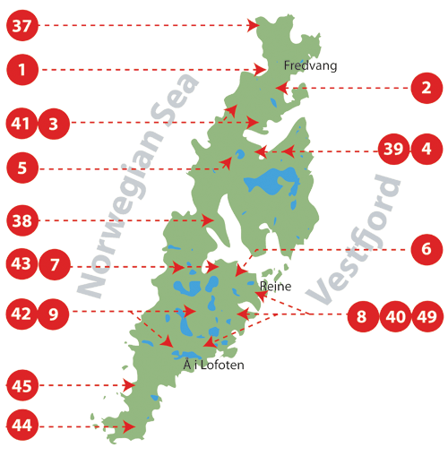
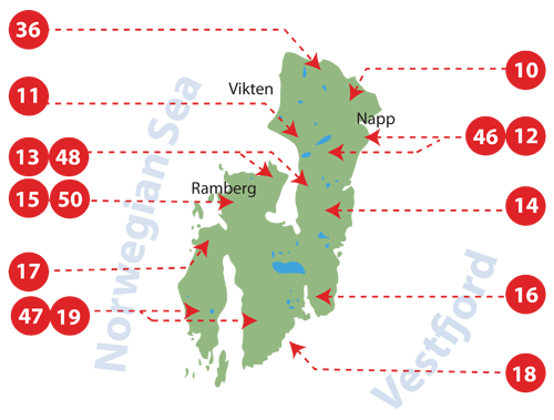
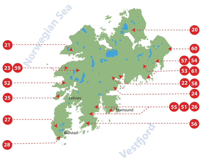
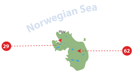
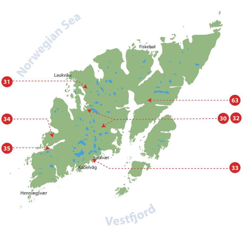
Hiking descriptions for Norway's Lofoten Islands, including the 91 greatest Lofoten hikes
TO GET ACCESS TO THE DAY-WALK FILES YOU HAVE TO BECOME A MEMBER. IF YOU ALREADY ARE A MEMBER, PLEASE LOGIN.
Click on an island to enlarge the map and see the different hikes.
Discover the long crossing from north to south on the Lofoten Islands (open acces)
List of hikes sorted by islands (from south to north of the Lofoten)
© Rando-Lofoten
© Rando-Lofoten
© Rando-Lofoten
© Rando-Lofoten
© Rando-Lofoten
© Rando-Lofoten
NETHERLANDS
DE NOORDERZON - Reisboekhandel
Nieuwstad 35,
6811BJ Arnhem - Nederland
Tel: +31(0)263510334 - www.denoorderzon.nl
English version only
FRANCE
ARIANE - LA LIBRAIRIE DU VOYAGE
20 rue du capitaine Dreyfus
35000 Rennes - France
Tel: +33 (0)2 99 79 68 47
www.librairie-voyage.com
French version only
LIBRAIRIE AU VIEUX CAMPEUR
2, rue de Latran
75005 Paris - France
Tel: +33 (0)1 53 10 48 33
www.auvieuxcampeur.fr/librairie
French version only
LA COMPAGNIE DES CARTES
Moose Crossing SARL
18 chemin de la briqueterie
33610 Canéjan
FRANCE
https://lacompagniedescartes.fr/
French and English version online
LIBRAIRIE LA GÉOTHÈQUE
14, rue Racine
44000 Nantes - France
Tel: +33 (0)2 40 74 50 36
https://www.facebook.com/La-Géothèque
French version only
LIBRAIRIE EYROLLES
Librairie Eyrolles
55, 57 et 61 boulevard Saint-Germain
75005 Paris - France
Tel: +33 (0)1 44 41 11 74
www.eyrolles.com
French version only
LIBRAIRIE ITINÉRANCES
62, rue Baudrière
49000 Angers - France
Tel: +33 (0)2 41 77 36 47
www.librairie-voyage-angers.fr
French version only
SWISS
LE VENT DES ROUTES S.A.
50 rue des Bains
CH-1205 Genève - Suisse
Tel: +41 22 800 33 81 - www.vdr.ch
French and English version
PAYOT LIBRAIRE
Place Pépinet 4
CH-1003 Lausanne - Suisse
Tél: +41 21 341 33 31 - www.payot.ch
English version only
PAYOT LIBRAIRE
Rue de la Confédération 7
CH – 1204 Genève - Suisse
Tél: +41 22 316 19 00 - www.payot.ch
English version only
BELGIUM
ANTICYCLONE DES AÇORES
Rue fossé aux Loups 34
1000 Bruxelles - Belgique
Tel: +32 02/217 52 46 - www.anticyclonedesacores.be
French and English version
NORWAY
RØDSAND LIBRIS LEKNES
Storgata 8,
8370 Leknes - NORWAY
Tel: +47 76 07 59 38
English version only
SKANDINAVISK HØYFJELLSUTSTYR BODØ
Torvgata 2,
8006 Bodø - NORWAY
Tel: +47 75 52 23 10 - www.skandinaviskhoyfjellsutstyr.no/Bodoe
English version only
RØDSAND LIBRIS SVOLVÆR
Vestfjordgata 8
8300 Svolvær - NORWAY
Tel: +47 76 07 59 22
English version only
BOKHUSET LIBRIS TROMSØ
Storgata 86
9008 Tromsø - NORWAY
Tel: +47 77 68 30 36
English version only
SWEDEN
NORSTEDTS FÖRLAGSGRUPP
Kartbutiken
Mäster Samuelsgatan 54
111 21 Stockholm - SWEDEN
Tel: +46 08 202 303 - https://www.kartbutiken.se/
English version only
You are a bookseller and want to be part of this list? Check our sales and shipping conditions in Europe.
WHY THIS GUIDE?
First, our passion for this archipelago, an inexhaustible reservoir of fantastic walks. And then, our experience in guiding groups of hikers over the past ten years. Finally, above all, we realized that up to now the available cartography has been limited to a collection of acceptable maps— but not quite acceptable for hiking. The trail indications are often meager and sometimes incorrect.
We wanted to remedy this fl agrant lack of reliable information as
completely as possible..
OUTLINE OF THE TOPO-GUIDE
Hiking the Lofoten Islands is both an invitation to discover this bit of Arctic paradise and a practical guidebook that answers two questions, essential for any hiker:
• Where should I hike on each of the islands, given the time I have, theweather, and my physical condition?
• What itineraries should I follow?
This guidebook is divided into three parts
- Part One is an introduction to the islands. You’ll fi nd general information on their geography, climate, geology, animal and plant life as well as advice on how to prepare for your hikes.
- Part Two is composed of 60 hiking topo-pages that include all the information you need—descriptions, maps and photos—to discover and appreciate the trails in the best possible way.
- Part Three describes a trek across the archipelago in 11 days. In addition to a detailed itinerary, it has all the tips you’ll need on food supplies and preparation for the hike and your bivouacs.
Buy this book?
You can order the book on Amazon or at traditional bookstores (see booksellers list here)
Order the book now on Amazon.fr
(shipping possible to all over Europe and most of the World, fixed price at: 28€)
You can also order the book on:
Amazon.es, Amazon.it, Amazon.nl (for the Netherlands and Belgium only)
If you want to support this website, please choose "Topo Guide Lofoten" seller when ordering (fixed price: 28€ or 24,07£)
PRACTICAL INFORMATION
Number of pages 224
Cover flexi-binding
Format 14,3 x 22,6 cm
Weight about 400g (1 lb.)
Price 28€ tax included
Bookstores Bookstores and resellers get a discount on our sales prices excluding taxes (without VAT). Depending on the quantity that is ordered, you can get from 25% up to 40% off.
You are authorized to fix your own retail price as long as it is not under our sales price (so you can sell it at a higher price).
For detailled information about: bookseller discounts, shipping costs, please send us an email at: This email address is being protected from spambots. You need JavaScript enabled to view it. and will send you a document will all the information that you need. For all orders, please send an e-mail to: This email address is being protected from spambots. You need JavaScript enabled to view it.
…and be sure to tell us the following:
Number of copies ordered
Contact (person responsible for the order)
Name and contact information of your bookstore (address, telephone, etc.)
Address and billing address (if different from bookstore address) Method of payment: When we’ve received your order, we’ll send you an e-mail with an invoice. You can pay by bank transfer (preferred), or through PayPal (either with a PayPal account or with a credit card).
Payment has to be done no later than 30 days after invoicing, we send the order within 2 business days. |
Vanessa and her partner Axel recently hiked the The Great Crossing of the Lofoten (end of September, 12 days). They are sharing some pictures and their notes that covers the entire trip in detail. If you are planning your own trip at this time of the year, you might wanna take a look.

November, frankly, isn't the happiest month of the year, at least on this side of the hemisphere and at my latitude, except maybe for die-hard mushroom pickers and rainboot lovers (they do exist!).
If I go back far enough in my memory, the arrival of the first mandarins and especially the prospect of my birthday on the near horizon, managed to color this brown and gray month with a certain joy and exitement.
Personally, I've been living in “November” for several months now, so for me it isn’t a big change. I do not intend to display my private life here on this informative website, of which the primary goal is above all to inspire people to travel and hike in the Lofoten Islands. I still want to share a bit with you readers.
A difficult and sad period has taken place in my life, and it explains directly why for several months there hasn’t been any new content published on the website, and why the forum has not been administered correctly (some of your posts were not published, or they were, but with delay). In short words: I lost the man of my life this summer to a cruel illness from which too few unfortunately recover, regardless of their courage or will. Losing him is a disaster for me (and his nearest), but it is also a loss for a greater number of people. Indeed, he has contributed actively for making the Lofoten Islands more accessible to all nature lovers. He created a real craze for this destination for over the past 15 years. David was an excellent photographer, a professional drone pilot, a mountain guide (with all the qualities that are needed to manage a website that’s serious about hiking), a programmer in his spare time, and much more. His interventions, tallent and generosity of time through articles, photos, films… will be greatly missed on this website.
Hiking-lofoten.net has and is, as I am, experiencing an unprecedented period.
For several months now, we have all collectively entered a strange and frustrating period, in which it is no longer possible (for the obvious good of all), to move and travel as we please. Whereas we always did it without even thinking about it. The restrictions on movement are more or less complicated to deal with depending on the country you are in, and I understand that being limited to a radius within a mile of your home (France) is something extremely frustrating to experience. No one can say how long this will last. But I think it’s safe to say that even this pandemic will end and the day will come when we can get our duffel bags out and start to pack. And then, maybe traveling will have a more intense flavour than before. Maybe we will realize that we are very privileged to be able to travel at all, and that one or two beautiful trips a year (or in a lifetime!), are worth more than a frantic consumption of destinations that have “to be done » at least once in a lifetime. And for the most extrem among us, that traveling on a more exceptional basis will bring much more satisfaction than the multiplying of long weekends on the other side of the continent (or of the globe), under the sole pretext that the tickets are cheap and that we still have a few capitals to tick off the list. But it's much harder to stay still than to be in movement. I know that all too well.
Of course, my fingers are crossed that I’ll be able to return to the Lofotens (my second home) as soon as possible, hoping for next spring or summer, and I know that many of you dream of getting there for the first time too. Patience, that day will come. After autumn and winter there is always a spring! In the meantime, even if you can't fix a date, there's nothing stopping you from planning your trip and dreaming about the magnificent hikes you will one day do. New practical content will also be posted on hiking-lofoten.net during this winter and spring, so keep an eye open. I will try to live up to the work that we have already done with David so far.
I wish you the most pleasant fall possible, stay cool and put things into perspective (that's what I'm trying to do). And above all, it cannot be repeated enough: the sooner the epidemic is contained - also thanks to our responsible collective behaviour - the sooner we can regain our freedom to come and go.
MAGDALENA
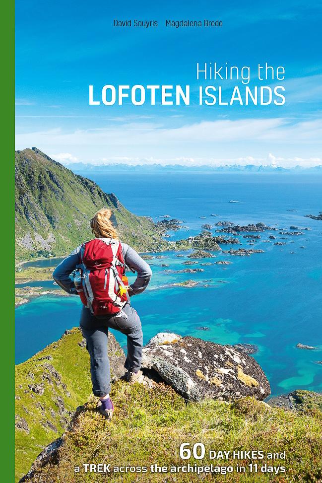
 Hiking the LOFOTEN ISLANDS
Start planning your trip to the Lofotens on the website (select hikes, download GPS tracks ...), and use our paper guidebook on the field!
New edition 2017
- 60 day hikes (including Værøya Island)
- 11-day trek across the archipelago
- 224 pages
- 325 color illustrations
- 89 maps The advantages of the guidebook: - a format that fits in a backpack (14 x 22 cm, weight: 430g approx.)
- the descriptions are even more detailed and accurate than on the site
- easy to know were you are on the field: the hike descriptions are divided into steps (marked: A, B, C, etc.), these steps are also marked on the maps
- the most reliable hiking guidebook on the Lofoten Islands, written by two mountain leaders that have been working and hiking for over 14 years in the archipelago Order the book on internet ou buy it at a bookstore:
on  (shipping possible to all over Europe (except Germany) and most of the World, fixed price at: 28€) (shipping possible to all over Europe (except Germany) and most of the World, fixed price at: 28€)
You can also order the book on: Amazon.es (all over the world), Amazon.it (all over the world), Amazon.nl (for The Netherlands and Belgium) If you are living in the Netherlands or in Belgium, you can also find the book on bol.com If you are living in Germany and want to buy the English version, please contact us directly: This email address is being protected from spambots. You need JavaScript enabled to view it. |
You have a bookshop and you would like to sell the guidebook?
With 100 more submits then the previous version !
New way how to discover the beauty of Lofoten is here. Over 250 panoramic photos connected into a virtual tour network will help you to plan your next hikes or revisit your old favourite destinations. Taken by Martin Kulhavy during his 5 visits to Lofoten. Over 400km hiked and 40km of elevation gained, really not an easy hobby. Please enjoy the views and feel free to send your comments or feedback to This email address is being protected from spambots. You need JavaScript enabled to view it.
Read more: Lofoten - Virtual Tour - 2020 update

Værøy Island is in the south of the archipelago, just 1 ½ hours by ferry from Moskenes, and while it’s less visited than its big sisters, it has splendid landscapes. They’re definitely worth the detour. All kinds of hikers can traverse a great part of the island on foot, whether it’s to Værøy’s rounded peaks or through its magnificent landscapes. Unlike in the rest of the archipelago, a real effort has been made here to mark out the trails and keep them in good condition. You’ll find the starting points of the hikes clearly indicated, with distance and time shown for each one. In addition to marked trails, the hikes have pretty signs placed in the different points of interest with old photos and explanations in Norwegian and English.
Discover the 7 best hikes on Værøy Island
* Værøy ferry schedule :
High Season
Low Season
Hiking-Lofoten Team

This very athletic trek combines the most beautiful summits of Moskenesøya Island into one big hike. It’s intended for people who don’t have the time to take longer treks (like the great hike across the Lofotens), but who like physical exertion in high-mountain landscapes. You should have some mountain experience and a good sense of direction, for aside from the height difference and distances you’ll have to cross, most of the hike will be off-trail, over wild, uneven terrain...
3 to 4 jours – leave : Sørvågen / arrive : Reine
Total distance : 39km
Height difference +/- 3600m, maximum altitude 1029m
Best season : July, August and Septembre
| Read more |

Frikart.no is a website that offers free downloadable maps!
Frikart.no propose both topographical hiking maps and road maps for all Norway.
Frikart maps quality is, in our opinion, as good as any other paying maps available on the market. Even better, frikart.no’s maps are on a single file that covers the entire Norway (instead of the 10 different maps files with Garmin® for example).
")
Stéphane Martineau, botanist and Moutain Leader, has contributed in various hiking, "nature" and Pyrenean fauna books. He is also the author of several publications on wild edible plants. His work has led him to hike through the Lofoten every summer since 2011. Through this article, fruit of his observations you will get the keys to understand this amazing mixture of alpine and marine vegetation, specific to the Lofoten Islands. |
| Read more |
")
White-tailed eagle on the lookout for fish in the Skjelfjord (photo Magdalena Brede)
View photo gallery

Every summer many climbers tackle the climb up Reinebringen on the island of Moskenesøya in the Lofoten archipelago. Many users of this site have asked us why we don’t mention this itinerary in the “Hikes” section. Here is our answer.
First of all, we do not consider the climb to the Reinebringen pass to be a hike a such. It is a very steep climb for roughly 1km leading to a small pass with a breathtaking view over the village and fjord of Reine.
Even though we don’t ignore such beautiful viewpoints and don’t baulk at climbing steep slopes to reach them, we don’t think this climb is worth the effort for the following reasons:
First of all, there are mountains nearby that have panoramic views that are just as impressive not only from the top but throughout the climb. In our opinion the Helvete hike to the top of Veinestinden is much more interesting than the Reinebringen hike! The same is true of Brunakseltinden or Munkan, for example.
The terrain to reach Reinebrigen is getting more and more dangerous. Each year the “track” deteriorates due to the large number of people hiking in an environment that is totally unsuitable. As a result the terrain, which is extremely steep, has become crumbly and ravines have formed. In many places only a few steeply sloping slabs remain that are very dangerous when the ground is wet. On this particularly steep track that is very demanding in places, some “hikers” have created new parallel tracks wherever they consider the previous track too worn out! The mountain side, which has been completely churned up by hikers, is gradually becoming a series of furrows that will encourage landslides and falling rocks. There are rumours that the Moskenes town council intend to develop the path, but so far nothing has been done.
While we are on the subject, we would like to remind you, and this applies to all hikes in the Lofoten islands, that in order to minimise the impact of hiking in this wilderness you must stick to any tracks that exist.
It is for these reasons, even though we fully understand the pride the locals must feel when they direct summer tourists to the viewpoint, that we do not consider this hike to be vital. For those who nevertheless feel they would like to tackle this climb, the GPX route is available on our website.
The Rando-Lofoten team
Since Rando-Lofoten was founded, a certain number of visitors have told us they would be interested in a trekking itinerary that crosses the archipelago from one end to the other. Crossing a region from north to south or east to west often enables travellers to set themselves a goal when faced with the unknown. But over and above the physical or psychological challenge we believe it is important to remember that hiking is above all about discovery and enjoyment.
In drawing up the following itinerary we gave ourselves the following goals:
- To avoid missing the most iconic places on the islands
- To avoid tarmacked sections of road wherever possible
- To hike as often as possible within easy reach of supply points (shops, petrol stations) to avoid having to carry an enormous rucksack!
Lastly, this itinerary is not the only possible one. Many of the hikes on the Rando-Lofoten site do not lie directly on the route of this crossing but are easily accessible if you branch off, provided you have the time and inclination.
The duration/distance of the stages we propose here is only a suggestion based on a reasonable level of fitness and decent weather, but it may be adapted to your own criteria. If you decide to camp you can pitch your tent virtually anywhere on the islands, provided of course that you comply with the regulations in force. Although water supplies are to be found everywhere at all stages, you will find relatively few food stores on the route. We have made a note of all the food supply points on this itinerary (shops, restaurants, petrol stations) that existed in 2014. To avoid disappointment, once you get there you should, however, check the opening times of these supply points when you leave each stage for the next...
Trekking in the Lofoten from north to south in 11 days
Detailed description of the "the great crossing of the Lofoten Islands"
(160 km distance and 9,193 m uphill)
| Read more |

Thanks to Martin Kulhavy for his fantastic Northern light pictures (see more pictures from the same author)
Find the answers to your questions in our new Northern light article
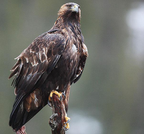
Photo: Kjetil Schjølberg
Leg of Lamb or Biodiversity?
We recently came across an article by the Norwegian Ornithological Federation (NOF) reproduced by the local Lofoten federation (Lofoten Lokallag) and it seemed important to share it with you here.
According to this article, the Norwegian parliament, under pressure from the lobby of sheep farmers and reindeer herders, is about to authorize hunting the golden eagle—a protected species everywhere in Europe and the rest of the world.
Read more
")


 Here then is an initial description of the route and my immediate overall impressions. Without saying any more before I give a complete account of the crossing, which will be uploaded shortly, I’d like to give anyone considering venturing in the Lofoten Islands a few essential items of information, in no particular order: the characteristics of the terrain and their impact, the unpredictable nature of the trails, vital requirements for such a crossing, a few tips and, of course, a few of the aspects that made the greatest impression on my journey...