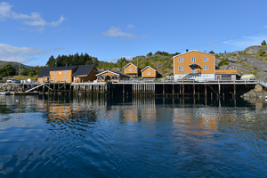
Pictures and track proposed by Halfdan Holm
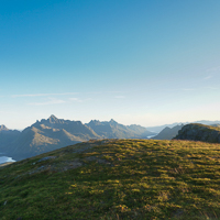
This trip takes you up to Småtinden (The small peaks), giving a view of both KabelvÂg, SvolvÊr and western Lofoten. There are several small peaks that can be climbed on this trip, including Varden, Varden's twin peak, and Stortinden.
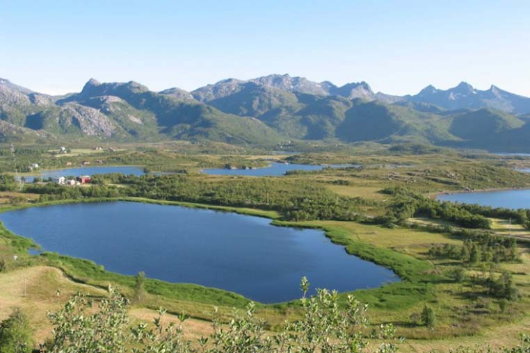
IThere are several possible ways you can start this trip, but common for them all is that the ascent starts at the southwestern corner of Stor-Kongsvatnet. You follow the trail up the ridge towards ÿrntindsaksla, which you pass on the north side. Keep to the north and you cross a small river which is also the last chance to fill up your water bottle. This section can be quite muddy and wet.
Now the trail may become somewhat unclear at times, but it should be possible to follow if you stop and look out for it at times. The trail continues up to the pass between the twin peaks, of which Varden is the northernmost one. From this pass one can reach all three of these small peaks. There is no visible trail to Stortinden, but you pass on the western side of Varden's twin and follow a ridge with a somewhat exposed eastern side. There is a path to Varden, and summiting it requires a bit of scrambling. Varden's twin can be reached without much difficulty. Same way back.
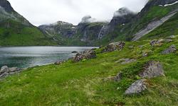
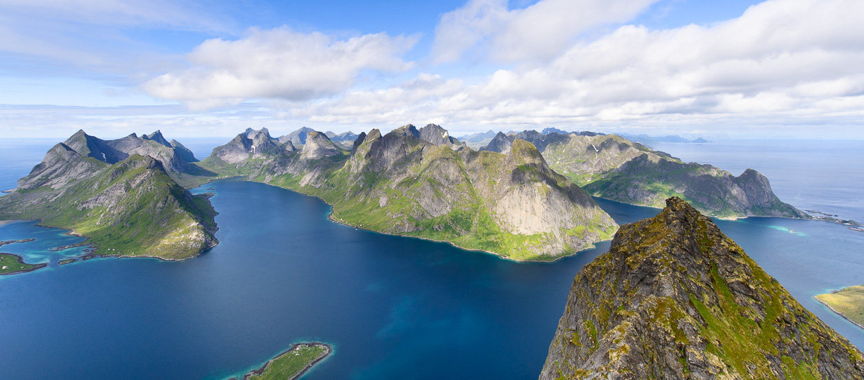
Another summit few people hike, yet it has an impressive view of Horseid beach to the west and over the Selfjord to the east. The summit is located along the itinerary of the big trek across the Lofotens between the Selfjord and the Kjerkfjord and can be climbed as an extension of that leg of the hike. The walk up to it doesn’t have any particular technical difficulty, but it is fairly long and crosses many wet, boggy areas that sometimes make progress difficult. Finally, from the Fagerdålen pass, the itinerary is off trail. Despite these difficulties, in clear weather the last part of this hike gives you a series of magnificent panoramas over the south of the islands.
The trail you’ll follow is pretty large at the start. It leaves from the parking lot and goes west along the bank of the Stomarkpollen a hundred or so yards away. The ground is quite wet and you’ll cross many bodies of water, wider or narrower depending on recent rainfall. A few parallel trails go through this large boggy meadow. But whichever you take, you’ll have a hard time keeping your feet dry. The trail then turns south and goes around the end of the Stormarkpollen fjord in a drier but hillier area and reaches the first body of water, which you cross. Then the trail meets the second body of water (Fageråa) and goes along it for about 200 yards, going up the little valley through a wooded area. Around 100 m (328 ft) of altitude, the trail reaches a boggy open meadow and reaches the first little lake. Next the trail follows the west bank of the big lake of Fageråvatnet through a maze of big rocks and dwarf birches. At the end of the lake, the trail slopes steeply up the little valley of Fagerådalen and reaches a pass between the 492 m point (1,615 ft) and the Markan summit. About 60 yards before reaching the pass, you leave the trail to take a right at the level of the bend at 400 m (1,312 ft). From then on, there’s no trace of a trail. If the weather is clear, you should see the summit of Branntuva in front of you (northwest), preceded by a pass 500 m (1,640 ft) high. Follow the bend at the level of roughly 430 m (1,410 ft) until you get below the pass, then climb the slope to get to it. From the pass, you have the best view of Horseid beach down below to the northwest. From there, climb up the south ridge of Branntuva, which is extremely rounded, avoiding the screes. Toward 680 m (2,231 ft), the slope becomes gentler and you find yourself on a grassy plateau. The cairn of Branntuva stands at the top of this plateau (702 m / 2,303 ft). From the summit, you have an impressive view of the jagged relief of the south of the island. Go back the same way.
Pictures and track proposed by Halfdan Holm
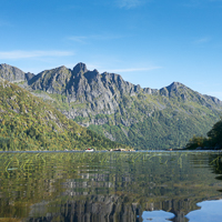
The trip up to Keiservarden (The Kaiser Cairn) is quick, but provides a stunning view of Raftsundet and some of the most alpine peaks in Norway. The viewpoint is named after Kaiser Wilhelm II who visited Digermulen, and this peak on several occations. The trip can be doubled in length to Snøtinden (The Snow Peak) providing a panoramic view over all the rugged peaks of eastern Lofoten.
Several maps show a trail going directly from Digermulen to Keiservarden. This route is however significantly exposed to rockfalls. Thus the trip starting about 1.5 km southeast of Digermulen will be described here. You will find the trailhead on the northern side of the road, just opposite a small parking lot. The trail starts out with an easy climb through the forest. After the turn to the left, you will have to pass some stretches of mud where you might get your feet wet. On the last stretch through the forest there are several points on the trail which can require a bit of scrambling. There are however ropes installed to help you keep your balance. At around 300m you break through the tree line. Here the trail can become somewhat faint, but if you follow the top of the ridge, you will soon see the two cairns marking the peak.
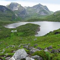
The trail up to Snøtinden continues along the ridge and down past a small lake and forest. After a small climb you see two more small lakes to the west, before ascending directly towards the summit. The trail continues around the southeast side of the peak before you reach the top. Same way back.
")