Hiking to Breidtinden


- Type of hike : Go back
- Visibility of the route : Good at the begining but poor at the end
- Start/Finish : At the crossroads leading to Reineveien and Ballstadlandet (near the boat shop).
- GPS Point : Start/finish: N68 04.489 E13 31.663
Summit: N68 05.436 E13 29.228
Description
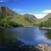
A fine hike through a varied landscape. Leaving Ballstad, the path winds around a number of tiny lakes before taking you towards the valley of Kyllingdalen. You then walk through a pinewood straight out of “Hansel and Gretel”.
More information about this hike...
|
Accessibility


Slideshow
View the embedded image gallery online at:
https://rando-lofoten.net/en/breidtinden-en?tmpl=component&print=1#sigProId1939f5e732

Download the route | Breitinden.gpx |
Join the start of the hike with Google Maps
You can use your actual location or enter the name of the place from which you wish to start