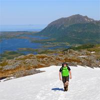
Hiking to Matmora
 Medium / Difficult
 Austvågøya
 5 to 6 hrs
 13.07 km
 1000 m
 776 m
776 m Vågan
Vågan Until June on the summit
- Type of hike : Crossing or in loop (if you come back by the road from Straumnes to Sandsletta)
- Visibility of the route : Medium
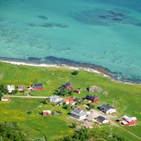
- Start/Finish : Delp/Sandsletta
- GPS Point : Start: N68 24.054 E14 30.236
Finish: N68 20.880 E14 29.723
Summit: N68 21.807 E14 30.859
Description
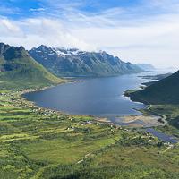
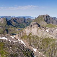
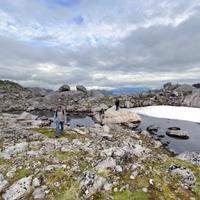
This is an excellent one-day hike to be tackled when the weather is fine. The summit is reached via a long line of peaks from which the views are as plentiful as they are magnificent.
More information about this hike...
|
|

Accessibility
 No
No Yes
Yes No
No
Slideshow

View the embedded image gallery online at:
https://rando-lofoten.net/en/hiking-to-matmora?tmpl=component&print=1#sigProId8e4bf827b2
https://rando-lofoten.net/en/hiking-to-matmora?tmpl=component&print=1#sigProId8e4bf827b2


Download the route |
Matmora.gpx |
Join the start of the hike with Google Maps
You can use your actual location or enter the name of the place from which you wish to start