Hiking to Nordlandsnupen
 Easy
Easy Værøya
 3 hrs
3 hrs 4.06 km
 490 m
490 m 457 m
457 m Vest-Lofoten
 Until April at the summit
- Type of hike : Go back
- Visibility of the route : Good
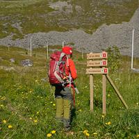
- Start/Finish : Leaving from the village of Værøy, take Route 791 toward the hamlet of Norland. Park, without blocking traffic, near the houses in the curve in the road at the far end of Breivika Bay. In the middle of the curve, a little sign indicates the start of the hike (same starting point as the Gjerdheia hike).
- GPS Point : Start: N67° 40.741' E12° 41.842'
Pass: N67° 41.083' E12° 41.147'
Summit of Breiviknupen: N67° 41.220' E12° 41.954'
Summit of Nordlandsnupen: N67° 41.266' E12° 42.122' - Note : A short passage just before the summit is slightly dizzying and should be avoided in humid weather. This hike can be combined with the Gjerdheia summit.
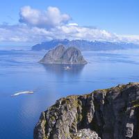
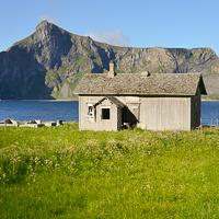
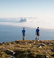
Not only is the summit of Nordlandsnupen the highest point on Værøy Island, but we think it’s the most beautiful. This relatively easy hike will quickly take you to an altitude high enough to give you magnificent views over the island of Mosken as well as over the whole southern tip of Moskenesøya Island. If you only have one day on Værøy and the sky is clear, go for it!
More information about this hike...
|
|

 Yes
Yes Yes
Yes No
No
https://rando-lofoten.net/en/hiking-to-nordlandsnupen?tmpl=component&print=1#sigProIdd47fee0fd5


Download the route |
Nordlandsnupen.gpx |
Join the start of the hike with Google Maps
You can use your actual location or enter the name of the place from which you wish to start