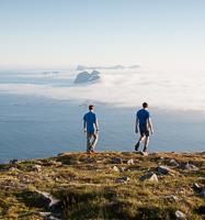
Hiking to Turtnbakka
 Difficult
 Moskenesøya
 5 to 6 hrs
 8.99 km
 851 m
851 m 670 m
670 m Vest-Lofoten
 Until may on the top
- Type of hike : Loop
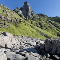
- Visibility of the route : No trail!
- Start/Finish : By boat from Å, head towards the southernmost point of Moskenesøya to the little bay located to the north of Svadodden where you will see a large landing-stage.
- GPS Point : Start/finish: N67 51.173 E12 54.095
Pass : N67 51.243 E12 52.081
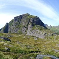
Summit of Gjerdtinden: N67 51.804 E12 52.210
Summit of Turtnbakka: N67 51.306 E12 51.104
Summit of Stortinden: N67 50.944 E12 52.162
Description
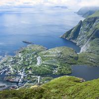
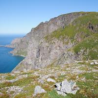
Ånstad is a 19th century former fishing village that was finally deserted in the 1940s when the inhabitants moved to larger villages such as Sørvågen. Today there remains only the landing-stage of the old port and a few foundations of houses scattered over the heathland.
More information about this hike...
|
|

Accessibility
 No
No Yes
Yes No
No
Slideshow

View the embedded image gallery online at:
https://rando-lofoten.net/en/hiking-to-the-plateau-of-turtnbakkheia?tmpl=component&print=1#sigProId949e2e3d81
https://rando-lofoten.net/en/hiking-to-the-plateau-of-turtnbakkheia?tmpl=component&print=1#sigProId949e2e3d81


Download the route |
Turtnbakka.gpx |
Join the start of the hike with Google Maps
You can use your actual location or enter the name of the place from which you wish to start