Hiking to Kartstaven
 Easy / Medium
 Vestvågøya
 4:30 hrs
 9.94 km
 550 m
550 m 534 m
534 m Vest-Lofoten
 Until May on the summit
- Type of hike : Return trip or loop
- Visibility of the route : Good to medium (if return trip)
- Start/Finish : If you are coming from Leknes head northwards (towards Svolvaer). Leave the E10 9km after Leknes, approximately 700m after the large Lake Sjerpvatnet that runs along the right-hand side of the road, and take the road to your right. Carry straight on for 1.7 km before turning left at Nykmarka where there are a few isolated houses and a small farm. The path begins alongside the farm and takes a tractor route that descends towards a few fields.
- GPS Point : Start/Finish: N68° 12.308' E13° 43.678'
Summit of Karstaven: N68° 11.637' E13° 47.870'
Peat hut: N68° 11.183' E13° 45.430' - Extensions : Randonnée facile/moyen en A/R, moyen/difficile en boucle
Description
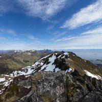
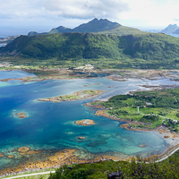
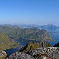
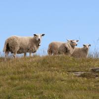
The top of Kartstaven, which is only 544m altitude, is in the centre of the island of Vestvagoya and offers a direct view over Vestfjord, which extends from the narrow Kartfjord. This hike is relatively easy and the trail is clearly marked if you choose to make a return trip.
More information about this hike...
|

Accessibility
 No
No Yes
Yes Yes
Yes Slideshow

View the embedded image gallery online at:
https://rando-lofoten.net/en/kartstaven-en?tmpl=component&print=1#sigProId09a50169fb
https://rando-lofoten.net/en/kartstaven-en?tmpl=component&print=1#sigProId09a50169fb


Download the route | Kartstaven.gpx |
Join the start of the hike with Google Maps
You can use your actual location or enter the name of the place from which you wish to start