Hiking to Kitinden

DifficultyDifficult
LocationMoskenesøya
Duration4 to 5 hrs
Distance7.65 km
Climb852 m
Maximum altitude742 m
Map - 1:50 000Vest-Lofoten
Snow riskUntil May on the summit
  • Type of hike : Go back
  • Visibility of the route : Non-existent
  • Start/Finish : 
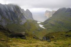
Parking close to the place called "Marka"
  • GPS Point : Start/finish: N68 02.642 E13 06.493
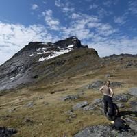
    Pass (view point): N68 02.868 E13 05.086
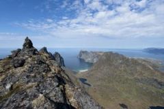
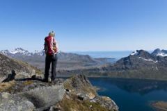
    Summit: N68 02.985 E13 04.759
kitinden-Lofoten
Description


This fabulous peak offers outstanding views over Kvalvika beach and the mythical Ulvtinden summit. To reach it you cross a wide variety of landscapes ranging from heathland to rugged black granite rocks via small wild mountainous plateaus.


More information about this hike...

Cover EN ptYou can read the detailed description of this hike (as well as 59 other hike descriptions), enjoy hundreds of photos, maps and practical information on the paper guidebook Hiking the LOFOTEN ISLANDS.
You'll find the guidebook on logo amazon en, as well as at the following bookstores, for 24,07£ (not including shipping).

Order on Amazon

Accessibility
No
No
No
Download the route
Kitinden.gpx

Join the start of the hike with Google Maps

You can use your actual location or enter the name of the place from which you wish to start

Other hikes nearby

Hiking to Moltinden (Mosk)

Hiking to Moltinden (Mosk)

Located at 0.1 km
Moskenesøya
DifficultéDifficult
7.2 km

Accessibility
No
No
No
Hiking to Ulvstinden

Hiking to Ulvstinden

Located at 2.0 km
Moskenesøya
DifficultéDifficult
9.6 km

Accessibility
No
No
No
Hiking to Branntuva

Hiking to Branntuva

Located at 2.1 km
Moskenesøya
DifficultéMedium / Difficult
13.7 km

Accessibility
No
Yes
No
From Selfjord to Kjerkfjorden

From Selfjord to Kjerkfjorden

Located at 2.1 km
Moskenesøya
DifficultéMedium / Difficult
9.2 km

Accessibility
No
Yes
No