Hiking to Trolldalstinden
 Medium / Difficult
 Vestvågøya
 5 hrs
5 hrs 10.37 km
 740 m
740 m 572 m
572 m Vestvågøy
 Until begining of June at the top
- Type of hike : Loop
- Visibility of the route : Good at the start, poor in the last part
- Start/Finish : Coming from Stamsund, take the fabulous road 815 to Valberg and stop at Vikjorda (Vikjorden) just before the Rebecca café. The path starts to the left of the café (do not park in the café car park, which is private, but on the roadside a hundred metres before it.)
- GPS Point : Start/Finish : N68 12.467 E13 39.498
Dalstuva : N68 13.228 E13 59.676
Summit of Trolldalstinden : N68 13.704 E13 59.965 - Note : The last part of this hike (level: difficult), between Dalstuva and Trolldalstinden is steep in places and can be dangerous in wet weather.
Description
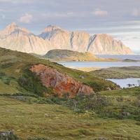
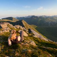
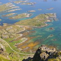
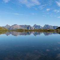
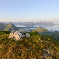
A good hike that will take you, ridge after ridge, through the open, maritime landscapes of this part of the large island of Vestvågøya. On the way back you walk through an unspoilt valley the length of three mountain lakes where the only noise is the occasional trout jumping…
More information about this hike...
|

Accessibility
 No
No Yes
Yes No
No Slideshow

View the embedded image gallery online at:
https://rando-lofoten.net/en/trolldalstinden-en?tmpl=component&print=1#sigProId89d701c582
https://rando-lofoten.net/en/trolldalstinden-en?tmpl=component&print=1#sigProId89d701c582


Download the route | Trolldalstinden.gpx |
Join the start of the hike with Google Maps
You can use your actual location or enter the name of the place from which you wish to start