Hiking to Tverrfjellet
 Medium
 Moskenesøya
 4 hrs
4 hrs 9.25 km
 596 m
596 m 496 m
496 m Vest-Lofoten
 Until May at the summit
- Type of hike : Go back
- Visibility of the route : Good then none
- Start/Finish : From the parking at the end of the gravel road at Selfjord (N68 02.188 E13 04.912)
- GPS Point : Start/Finish : N68 02.188 E13 04.912
Summit : N68 01.437 E13 04.276
Description
Route proposed par Halfdan Holm
The start is the same as for the trip "Selfjord-Kjerkfjord", this means; at the end of the gravel road at Selfjord.
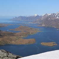
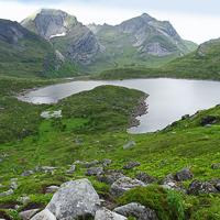
The begining is quite wet, but when you start gaining altitude, it gets dryer, though its probably too late. Turn towards the East just before the lake of Fageråvatnet. The path disapeares before you start with the real climbing. When you’re up on the ridge, and start walking towards Tverrfjellet, the magnificent Selfjord begins to show. Same way back.
Accessibility
 No
No Yes
Yes Yes
Yes Slideshow
View the embedded image gallery online at:
https://rando-lofoten.net/en/tverrfjellet-en?tmpl=component&print=1#sigProId719131a966
https://rando-lofoten.net/en/tverrfjellet-en?tmpl=component&print=1#sigProId719131a966
Video

Download the route | Tverrfjellet.gpx |
Join the start of the hike with Google Maps
You can use your actual location or enter the name of the place from which you wish to start

Other hikes nearby
From Selfjord to Kjerkfjorden
Located at 0.0 km
 Moskenesøya
 Medium / Difficult
 9.2 km
Accessibility
 No
No Yes
Yes No
No


