Since Rando-Lofoten was founded, a certain number of visitors have told us they would be interested in a trekking itinerary that crosses the archipelago from one end to the other. Crossing a region from north to south or east to west often enables travellers to set themselves a goal when faced with the unknown. But over and above the physical or psychological challenge we believe it is important to remember that hiking is above all about discovery and enjoyment.
In drawing up the following itinerary we gave ourselves the following goals:
To avoid missing the most iconic places on the islands
To avoid tarmacked sections of road wherever possible
To hike as often as possible within easy reach of supply points (shops, petrol stations) to avoid having to carry an enormous rucksack!
Lastly, this itinerary is not the only possible one. Many of the hikes on the Rando-Lofoten site do not lie directly on the route of this crossing but are easily accessible if you branch off, provided you have the time and inclination.
The duration/distance of the stages we propose here is only a suggestion based on a reasonable level of fitness and decent weather, but it may be adapted to your own criteria. If you decide to camp you can pitch your tent virtually anywhere on the islands, provided of course that you comply with the regulations in force. Although water supplies are to be found everywhere at all stages, you will find relatively few food stores on the route. We have made a note of all the food supply points on this itinerary (shops, restaurants, petrol stations) that existed in 2014. To avoid disappointment, once you get there you should, however, check the opening times of these supply points when you leave each stage for the next...
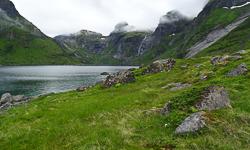
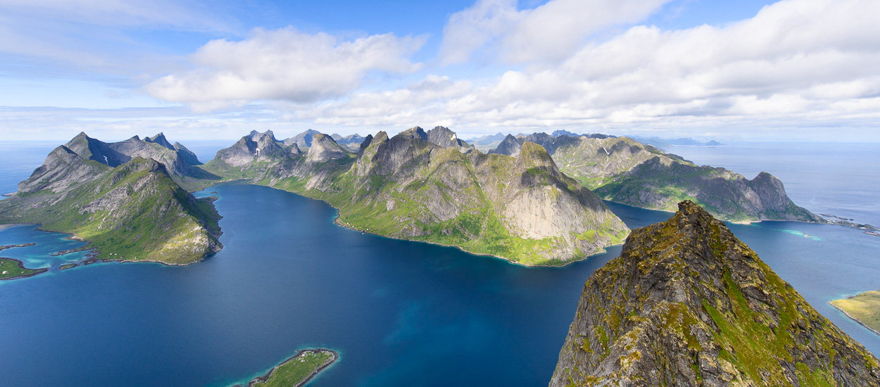
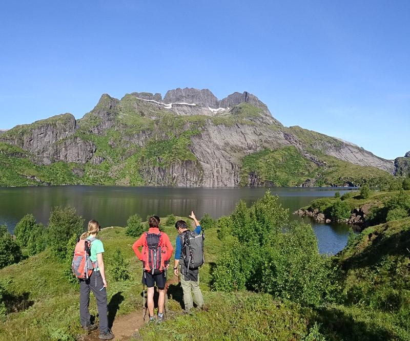
Trekking in the Lofoten from north to south in 11 days Detailed description of the "the great crossing of the Lofoten Islands" (160 km distance and 9,193 m uphill)
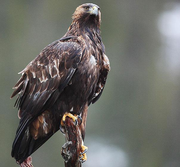
We recently came across an article by the Norwegian Ornithological Federation (NOF) reproduced by the local Lofoten federation (Lofoten Lokallag) and it seemed important to share it with you here.
According to this article, the Norwegian parliament, under pressure from the lobby of sheep farmers and reindeer herders, is about to authorize hunting the golden eagle—a protected species everywhere in Europe and the rest of the world.
Hiking fans and fishing enthusiasts! I wish to share this video with you.
The video summarizes what I would call a Fishing Trek that stretches between step 6 and 10 of the “Great crossing of the Archipelago” proposed on this website. We travelled in late July / early August 2016, and since we had only 10 days of vacation, we privileged the last part of the “Great crossing of the Archipelago” (the most beautiful and the one that seemed most suitable for fishing). We also decided to cut the stages of the trek in two: 1) to be able to walk more "tranquillo" 2) to bivouac on the water's edge and allow us enough daily fishing time Between salt and fresh water the spots are plenty and the fish abound!! This trip was magical! : Lol: Your website is really great and it's thanks to you that we could organize this trip so easily. Don’t hesitate if you have any questions about the trek, I will be happy to answer.
(text above translated from French by Hiking-Lofoten)
Alex "Rudankort" Shargin is a long-time enthusiast of Norwegian arctic islands. After first visiting Lofoten in winter 2010 he fell in love with the region and returned many times since. "Cloud Symphony" is his attempt to show the exceptional beauty of Lofoten using cool new technologies like time-lapses and aerial footage shot from drones. Most of the sequences were recorded between sunset and sunrise when the light is most spectacular and all tourists are asleep. BTW, a great way to explore Lofoten in high season! You can see more photos from Alex and follow his future projects here.
The Lofoten archipelago from North to South in 9 days
Here then is an initial description of the route and my immediate overall impressions. Without saying any more before I give a complete account of the crossing, which will be uploaded shortly, I’d like to give anyone considering venturing in the Lofoten Islands a few essential items of information, in no particular order: the characteristics of the terrain and their impact, the unpredictable nature of the trails, vital requirements for such a crossing, a few tips and, of course, a few of the aspects that made the greatest impression on my journey...
Planning your hiking trip to the Lofoten Islands? Don't wait to be on site, and get them online at the "Maps Company", our official partner.
Maps Company is selling travel and hiking maps for all over the planet. The products are shiped within 24 hours, all over the world. They offer over 17,000 travel and hiking maps (over 200 countries).
If you want to go from Forsfjord power station to Vindstad (or vice versa), and you don’t want to rely on the boat shuttle MS Fjordkyss, it is now possible to do it by foot.
We provide GPX track, map and the description (in french only) for the section connecting Vindstad to Forsfjord. This new possibility is particularly interesting for hikers engaged in the great crossing of the Lofoten Islands trek.
As we are not a tourist office, we will only publish recommandations for places we think are hikers and backpackers friendly and that we have tested AND appreciated. This section will get more stuff as we go along.
161,424 users, 24,000 subscribers and over 1,500,000 pages viewed in 2018!
To find out more about all the Rando-Lofoten visitor statistics with accurate data from Google Analytics, click here.
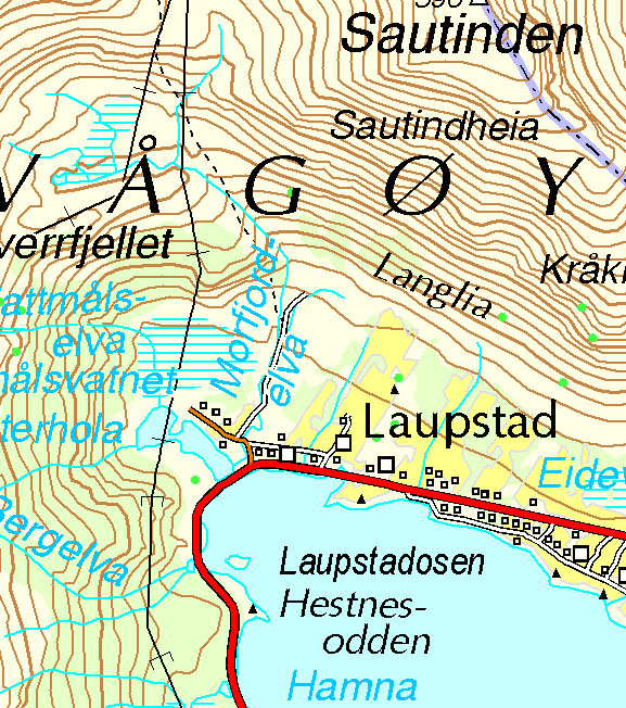
Increasingly accurate maps!
The Day Walks section has been improved thanks to the work of Frank Ingermann and the fantastic vector map background of Norgeskart.no (Norwegian Mapping Authority - Karverket). Hiking-Lofoten offers hiking guides that are getting ever more accurate and professional. Come and find out about them!
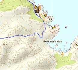
Download the official Lofoten Islands maps
Lofoten Islands maps, scale 1:50 000 (UMT33) download them for free on hiking-lofoten!Maps from the Norwegian National Institute of Cartography (Kartverket) are available in high definition (Tiff) on a set of ten maps. Essential to prepare your hikes in the Lofoten Islands...
The GPS hiking routes are finally available as free downloads from the Hikes section!
Discover eight new routes in the Lofoten Islands with detailed Topos from Rando-Lofoten.
Day Length in the Lofoten
The Lofoten archipelago is located above the Arctic Circle, the result of this situation is a period of permanent days in summer and at the opposite a period of permanent night in winter (polar night).
To organize properly your trips and expedition in this region, it is important to take this phenomenon into account due to the high latitude. Discover our sunset/sunrise calendar
")


 Here then is an initial description of the route and my immediate overall impressions. Without saying any more before I give a complete account of the crossing, which will be uploaded shortly, I’d like to give anyone considering venturing in the Lofoten Islands a few essential items of information, in no particular order: the characteristics of the terrain and their impact, the unpredictable nature of the trails, vital requirements for such a crossing, a few tips and, of course, a few of the aspects that made the greatest impression on my journey...