")


Hiking to Andstabben
 Medium
 Moskenesøya
 3:30 hrs
 5.11 km
 620 m
620 m 523 m
523 m Vest-Lofoten
 Until May at the top
- Type of hike : Go back
- Visibility of the route : Medium
- Start/Finish : Behind the parking at "Å i Lofoten" (just after the tunnel)
- GPS Point : Start/Finish : N67 52.787 E12 58.642
Summit : N67 52.631 E12 56.883 - Note : This trail contain some steep sections where you will need to scramble. Risk of vertigo at the top.
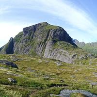
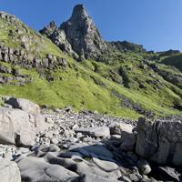
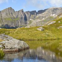
Despite two tricky sections, this short hike takes you rapidly to a fantastic view point over the southern-most point of the island of Moskenesøya and Lake Ågvatnet. Located only a few kilometres from the summit of Tindstinden and of equivalent difficulty, the climb up Andstabben offers an even more impressive panoramic view.
More information about this hike...
|
|

 No
No No
No No
No
https://rando-lofoten.net/en/andstabben#sigProId4677978a2a


Download the route |
Andstabben.gpx |
Join the start of the hike with Google Maps
You can use your actual location or enter the name of the place from which you wish to start