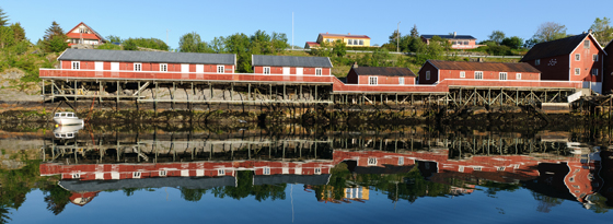
Rorbus are charming fisherman’s huts, often on stilts, but the level of comfort is quite basic. Despite being built on the coast they are the equivalent of our mountain refuges. They are generally equipped with a kitchenette and a communal area and all have toilets, hot showers and electricity to compensate for the climate which can sometimes be harsh at these latitudes. The bedrooms sleep 2 to 8 people, more often than not in bunk beds. In certain places the beds are on small high platforms directly under the roof. Even though the  accommodation may be a little basic, it is more than made up for by the beautiful landscapes and the fact that you will spend most of your time hiking in the countryside...


Exploranor base camp in the Lofoten Island (Sorvagen)

People on a tight budget should know that Norwegian law allows “wild camping” everywhere (certain restrictions apply in national parks). If you decide this is for you, you should try to keep a reasonable distance away from houses. Don’t pitch your tent on farming land that is clearly being worked and has been fenced in; such land is rare and pitching your tent on it could be taken as provocation. If you do want to camp less than 500 metres from a farm or isolated dwellings, use your best English to go and check that nobody minds.
Lastly, try to remember that although Norwegians are not sticklers about private property, they are when it comes to ecology and tidiness. So leave your campsite clean and tidy when you leave!

Search the site ...

Connection

In order to access certain services available on our site, (participation in forums, access to hiking sheets) you must register.

Our tips

Where to sleep, eat, drink and more in the Lofoten Islands

As we are not a tourist office, we will only publish recommandations for places we think are hikers and backpackers friendly and that we have tested AND appreciated. This section will get more stuff as we go along.

Latest news

 Visitor statistics

161,424 users, 24,000 subscribers and over 1,500,000 pages viewed in 2018!

To find out more about all the Rando-Lofoten visitor statistics with accurate data from Google Analytics, click here

 Increasingly accurate maps!

The Day Walks section has been improved thanks to the work of Frank Ingermann and the fantastic vector map background of Norgeskart.no (Norwegian Mapping Authority - Karverket). Hiking-Lofoten offers hiking guides that are getting ever more accurate and professional. Come and find out about them!

norgeskart-


Download the official Lofoten Islands maps

Lofoten Islands maps, scale 1:50 000 (UMT33)  download them for free on hiking-lofoten!Maps from the Norwegian National Institute of Cartography (Kartverket) are available in high definition (Tiff) on a set of ten maps.  Essential to prepare your hikes in the Lofoten Islands...

Lofoten maps

Northern lights forecast

Discover aurora forecast for Lofoten islands, thanks to NOAA POES satelitte from the "National Oceanic and Atmospheric Administration"

GPS routes

  • The GPS hiking routes are finally available as free downloads from the Hikes section!
  • Discover eight new routes in the Lofoten Islands with detailed Topos from Rando-Lofoten.

Day Length in the Lofoten

The Lofoten archipelago is located above the Arctic Circle, the result of this situation is a period of permanent days in summer and at the opposite a period of permanent night in winter (polar night).

To organize properly your trips and expedition in this region, it is important to take this phenomenon into account due to the high latitude. Discover our sunset/sunrise calendar

Copyright

Any representation whether total or partial of this site or content (general structure, texts, sound, logos, images whether animated or otherwise), by any method whatsoever, without the authors express prior approval is prohibited and constitutes infringement sanctioned by the Intellectual Property Code. The GPX tracks that can be downloaded on this website, bellong to hiking-lofoten and is for a private use only (not for commercial use). In order to reproduce the tracks in any form or on any medium (paper, digital, website, etc.), we ask you to mention the following (under or on the map): GPX track © hiking-lofoten.net