An Athletic Trek in the South of the Lofoten Islands


An Athletic Trek in the South of the Lofoten Islands


3 or 4 days – leave : Sørvågen / arrive : Reine
Total distance : 39km, Height difference +/- 3600m, maximum altitude 1029m
Season : July, August and September


This very athletic trek combines the most beautiful summits of Moskenesøya Island into one big hike. It’s intended for people who don’t have the time to take longer treks (like the great hike across the Lofotens), but who like physical exertion in high-mountain landscapes. You should have some mountain experience and a good sense of direction, for aside from the height difference and distances you’ll have to cross, most of the hike will be off-trail, over wild, uneven terrain.

It is preferable to make this trek in 4 days to get the most out of the places you’ll hike through, but if you’re in a hurry, it’s possible to get back to the village of Reine in the afternoon of day 3. To do that, you’ll have to get to Vinstad before the last ferry leaves at 3:25 PM (see schedules here). However, as Bunes Beach is a magnificent spot to bivouac and admire the midnight sun, we think you’d do better to take your time and spend the third night in this beautiful place...

NOTE: There are no refueling points beyond Sorvagen, you must start this trek with 3 to 4 days of food (Or a good fishing rod ;-)

Complete trek map (below)

Stage n°1 – From Sørvagen to Krokvatnet Lake

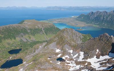
Don’t be fooled by the distance of this leg of the hike: it goes over the summit of Støvla and it’s the hardest part of the itinerary, along with Stage No. 2. Only do it if the snow has totally disappeared from the summit. Some passages of the ascent go along extremely slanted slopes over Fjerddalsvatnet Lake and when there’s snow, the passage can be dangerous—in fact, impossible. The ascent to the summit as well as the way back down to the lake pass through screes and highly uneven terrain where a GPS may be necessary. But what a reward, when you get to the top of Støvla and its 360° panorama over the south of the archipelago!

When you get back down, you’ll find several places to bivouac between Lakes Krokvatnet and Tennesvatnet. The point we suggest here is a little rounded promontory that gives you a lovely view over the fjord of Forsfjorden. From there, you’ll be ready to set out on the ascent of Herrmannsdalstinden the next morning.
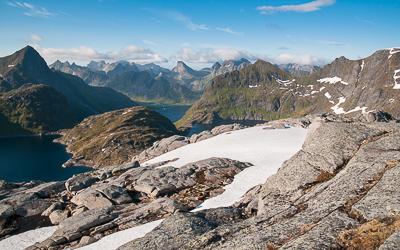
View from Støvla summit (Hikin-lofoten.net)

Leave : Sørvågen (N67° 53.474’ E13° 00.608’)
Arrive : hill 440m, between the lake of Krokvatnet and Tennesvatnet (N67°56.013’ E12°58.738’)
Distance : 11km
Time of trip : 6 to 7h
Height difference : +1276m/-789m
Maximum altitude : 824m
Bivouac : possible everywhere
Place to get water : all along the trail
Places to get food : Sørvågen (Joker, Matkroken)
Note : Some passages are dangerous if snowed (you will find snow until july normaly). A gps device is very useful especially in the downhill
Other nearby hikes : Tindstinden, Munkan


Stage n°2 – Hermannsdalstinden Summit (1,029 m / 3,376 ft) and the valley of Hermannsdalsvatnet

This is the longest leg of the trek—and the most extraordinary in terms of the landscapes you will hike through. You’ll first reach the highest summit of Moskenesøya Island (Hermannsdalstinden – 1,029 m / 3,376 ft); then a wild, not very accessible valley that reaches the west coast of the island. Just as for the Støvla summit, it is not advisable to venture onto the summit of Hermannsdalstinden if it is still covered with snow: there’s a risk of avalanches and falling rocks. It is important to manage your effort carefully during this leg of the hike, for once you reach the summit, you still have a long way to go. The climb back down to the fjord of Forsfjorden and the trail along the fjord are both quite challenging and you still have to go through a second pass (500 m / 1,640 ft of height difference) to reach the valley of Hermannsdalen. As you walk along Hermannsdalsvatnet Lake, you’ll reach an area of meadows between the lake and the sea. It’s an ideal place to set up your bivouac, particularly on the butte of Sandhågen to the south. The sea is hard to reach at this spot, but Hermannsdalsvatnet Lake has many places where you can swim or fish.

hiker on the top of Hermannsdalstinden - 1029m (hiking-lofoten.net)

Leave : hill 440m, between the lake of Krokvatnet and Tennesvatnet (N67°56.013’ E12°58.738’)
Arrive : mound of Sandhågen (N67° 57.363’ E12° 54.475’)
Distance : 15,2km
Time of trip : 7 to 8h
Height difference : +1493m/-1918m
Maximum altitude : 1029m
Bivouac : possible everywhere
Place to get water : all along the trail
Places to get food : none
Note : Passages near the void during the ascent of the summit of Hermannsdalstinden. Avoid this climb if the summit is still cover of snow. The trail between Forsfjord and Vindstad is narrow and scabrous in places, especially if you are heavily loaded.
Other nearby hikes : none


Stage n°3 – From Hermannsdalsvatnet to Bunes Beach

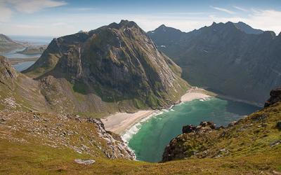
This leg of the trek is easier and shorter than the first two. It takes you to the famous beach of Bunes (or Buneset), which faces the Norwegian Sea. First, you must leave the valley by the same trail you took to get there, to the pass that overlooks Vindstad and Forsfjorden. Next, you’ll take a little trail that goes around the summit of Håtinden by the north and goes back down onto the little road that connects Vindstad to the end of the Bunesfjorden fjord. In summer, many people hike from Vindstad to Bunes Beach, for it’s an easy walk. So you probably won't be alone on this part of the hike. Even though it’s relatively crowded, the place is worth discovering and the beach is a very good spot to bivouac. If you don’t want to spend the night on Bunes Beach and you’ve decided to go directly back to Reine on the ferry, keep in mind that the last ferry of the day leaves at 3:25 PM and you’ll need to be there twenty minutes ahead of time if you want to be sure to get on (the number of people the boat can take is limited).

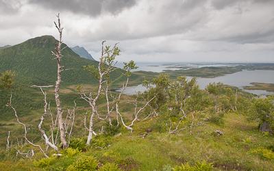
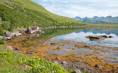
lonely farm in Hermannsdalen valley (hiking-lofoten.net)Leave : mound of Sandhågen (N67° 57.363’ E12° 54.475’)
Arrive : Bunes beach (N67° 58.674’ E12° 57.675’)
Distance : 9km
Time of trip : 3 to 4h
Height difference : +658m/-666m
Maximum altitude : 494m
Bivouac : possible everywhere
Place to get water : first part of the trail and in Vindstad
Places to get food : none
Note : none
Other nearby hikes : Brunakseltinden


Stage n°4 (if you’ve opted for 4 days) – Bunes Beach – Reine (Ferry from Vindstad)

This last stage is extremely short. It takes you to the pier of the ferry at Vindstad, where you can take one of the shuttles that go to the village of Reine on the other side of the fjord (see ferry schedules).
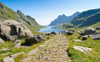
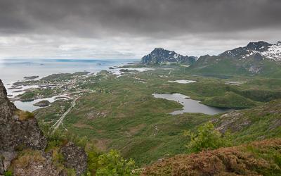
Trail leading to Bunes beach (hiking-lofoten.net)

Leave : Bunes beach (N67° 58.674’ E12° 57.675’)
Arrive : Quay of vindstad (N67° 57.477' E13° 00.223')
Distance : 3,2km
Time of trip : 45min
Height difference +/- : 100m
Maximum altitude : 76m
Bivouac : Not possible in the village of Reine
Place to get water : Vindstad or Reine
Places to get food : Reine (Cop Marked or Circle K gaz station)
Note : come at least half an hour in advance at the ferry departure quay in the full saeson
Other nearby hikes : Reinebringen, Veinestinden


 

Ferry's schedules (Vindstad/Reine/Vindstad)

The long crossing from north to south on the Lofoten Islands


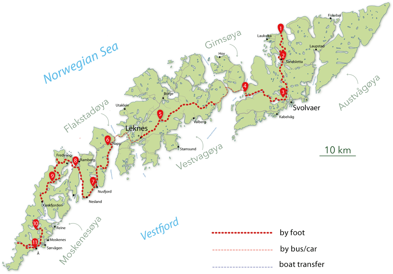
Carte trek 11 jours Etape 1 Etape 2 Etape 3 Etape 4 Etape 5 Etape 6 Etape 7 Etape 8 Etape 9 Etape 10 Etape 11

The MS Fjordskyss boat(http://www.reinefjorden.no), which is suposed to link Reine to Vindstad, Kjerkfjord and Forsfjord has some time "dificulties" to stop at Forsfjord power station.
Since it is also possible to walk from Vindstad to Forsfjord, we have decide to give you the GPX track for this part (only in french), in case the boat driver is too tired to drive you to Forsfjord that day ;-)

Since Rando-Lofoten was founded a certain number of visitors have told us they would be interested in a trekking itinerary that crosses the archipelago from one end to the other. Crossing a region from north to south or east to west often enables travellers to set themselves a goal when faced with the unknown. But over and above the physical or psychological challenge we believe it is important to remember that hiking is above all about discovery and enjoyment.

In drawing up the following itinerary we gave ourselves the following goals:

  • To avoid missing the most iconic places on the islands
  • To avoid tarmacked sections of road wherever possible
  • To hike as often as possible within easy reach of supply points (shops, petrol stations) to avoid having to carry an enormous rucksack!

Lastly, this itinerary is not the only possible one. Many of the hikes on the Rando-Lofoten site do not lie directly on the route of this crossing but are easily accessible if you branch off, provided you have the time and inclination. The duration/distance of the stages we propose here is only a suggestion based on a reasonable level of fitness and decent weather, but it may be adapted to your own criteria. If you decide to camp you can pitch your tent virtually anywhere on the islands, provided of course that you comply with the regulations in force. Although water supplies are to be found everywhere at all stages, you will find relatively few food stores on the route. We have made a note of all the food supply points on this itinerary (shops, restaurants, petrol stations) that existed in 2014. To avoid disappointment, once you get there you should, however, check the opening times of these supply points when you leave each stage for the next.

Remember that Rando-Lofoten is above all a participatory site and any suggestions to improve this itinerary, either in the forum or by email, are welcome.

Enjoy your hike!


Crossing the Lofoten Islands in 11 stages

160km and 9,193 m uphill


Island of Austvågøya

Stage No. 1 – Delp/Sandsletta

View over the plateau leading to Matmora Departure: hamlet of Delp (N68 24.065 E14 30.171)
Arrival: hamlet of Sandsletta (N68 20.163 E14 29.907)
Distance: 12.8 km
Duration of hike: 5 h
Uphill: 927 m
Camping: possible everywhere
Campsite near the point of arrival: Sandsletta campsite (N68 20.163 E14 29.907) inexpensive and good service.
Supply point(s): Sandsletta campsite (small convenience store + restaurant).
Note: It is a good idea to do your shopping in Svolvaer.


Stage No. 2 – Sandsletta/Svolvaer

Haugen near Sandsletta Departure: hamlet of Sandsletta (N68 20.163 E14 29.907)
Arrival: near Svolvær (N68 14.646 E14 32.094)
Distance: 13 km
Duration of hike: 6 h
Uphill: 697 m
Camping: possible everywhere
Campsite near the point of arrival: Lofoten Feriesenter (N68 14.879 E14 32.939) high prices and poor service.
Supply point(s): Sandsletta campsite, small convenience store + restaurant. Svolvær, several shopping centres and shops in the town centre - N68 14.045 E14 33.690. Caution: there is nowhere to buy supplies in any of the next three stages.
Nearby hikes: Rundfjellet (Only for registerd users).


Stage No. 3 – Svolvaer/Kleppstad

Near de Svolvaer Departure: near Svolvaer (N68 14.646 E14 32.094)
Arrival: hamlet of Kleppstad (N68 15.554 E14 16.666)
Distance: 17.3 km
Duration of hike: 8 h
Uphill: 644 m
Camping: possible everywhere
Campsite near the point of arrival: None
Supply point(s): None
Nearby hikes:Tjeldbergtinden (Only for registerd users).


Island of Vestvågøya

Stage No. 4 – Vikjorda/Lake of Store Krenggårsvatnet

Note: in order to get to the starting point of this stage you have to cross 14 km of tarmacked road that cannot be avoided of which 6.3 km on the main E10 road and 6.5 km on the minor 815 road. It’s not much fun walking on the road and we recommend you try to hitchhike, particularly along the stretch of the E10 road that is quite busy in summer and therefore potentially dangerous. The 6.5 km stretch along the 815, from the second bridge, is far less busy and may therefore be walked.
Behind Vikjorda Departure: hamlet of Vikjorda (N68 13.631 E14 04.605)
Arrival: Lake of Store Krenggårsvatnet (N68 11.219 E13 45.426)
Distance: 19.5 km (not including the section of tarmacked road)
Duration of hike: 7 h (not including the section of tarmacked road)
Uphill: 1,392 m
Camping: possible everywhere but there is a well-equipped cabin, which is freely accessible, near the lake of Store Krenggårsvatnet (or Store Kringlebotnsvatnet depending on which map you consult)
Campsite near the point of arrival: None
Supply point(s): None
Nearby hikes:Vikjordstinden, Trolldalstinden, Blåtinden, Kartstaven (Only for registerd users).


Stage No. 5 - Lake of Store Krenggårsvatnet/town centre of Leknes

Note: This is the final stage on the island of Vestvågøya. As it is relatively short it’s a good idea to buy supplies in Leknes (the largest town on the islands) and find means of transport to cross the second stretch of the road that is not hiker-friendly but connects Leknes to the village of Napp on the island of Flakstadøya. This stretch of the E10 covers a distance of 13.5 km and includes a section of highway and a tunnel under the sea that is prohibited to pedestrians!

There are two ways of getting to the village of Napp: either hitchhiking or by bus. The bus leaves from near the Statoil petrol station in the town centre (N68 08.911 E13 36.783). When you reach Napp take the little road on the left and walk approximately 800 m to the wharf south of the port. The trail begins from the wharf (N68 07.744 E13 26.278) and you will soon find a number of quiet spots to camp along the coast.

Special Notice: Thanks to an unfriendly farmer who did not appreciate to see a few hikers’ crossing his property we have decided to propose you a new trail for stage 5. The last part of the route has been modified and it is now better, although a bit longer, then the previous one ;-)
The part starting from Hagskaret pass has a nice and easy trail all the way to the road 997 (Fygle – Ramsvika)

View towards Kartstaven Departure: Lake of Store Krenggårsvatnet (N68 11.219 E13 45.426)
Arrival: Rema 100 super market, Leknes (N68 08.684 E13 37.265)
Distance: 11 km
Duration of hike: 3.30 h
Uphill: 221 m
Camping: complicated around the town of Leknes but anywhere you like from the village of Napp.
Campsite near the point of arrival: None
Supply point(s): town of Leknes, the last real supply point for the next two stages!
Nearby hikes:Justadtinden, Slettheia, Guratinden (Only for registerd users).


Island of Flakstadøya

Stage No. 6 – hamlet of Napp/hamlet of Nusfjord

Sordalsvatnet halfway along the stage

Departure: car park at the end of the wharf in Napp (N68 07.744 E13 26.278)
Arrival: hamlet of Nusfjord (N68 02.056 E13 20.891)
Distance: 17.6 km
Duration of hike: 8 h
Uphill: 953 m
Campsite: continue for roughly 800 m after the village of Nusfjord, you’ll find a number of spots to camp at the beginning of the trail to Nesland (N68 01.765 E13 20.952).
Campsite near the point of arrival: None
Supply point(s): small shop (very expensive) in the village of Nusfjord open only in the high season. A café/restaurant is also open in the high season near the wharfs (expensive).
Nearby hikes:Stornappstinden, Store Klauva, Hestraeva, Nesheia (Only for registerd users).


Stage No. 7 – hamlet of Nusfjord/Village of Ramberg

Note: accessing the village of Ramberg adds approximately 3 km (round trip) to the route to the south of the Lofoten. But Ramberg is also the only place you can buy supplies for the next two stages. The little Bunnpris shopping centre in the centre of the village is not only reasonably priced for Norway, it also offers a wide range of goods.
Nusfjord Departure: near the hamlet of Nusfjord (N68 01.765 E13 20.952)
Arrival: near the village of Ramberg (N68 04.469 E13 12.468)
Distance: 19.7 km
Duration of hike: 7 h
Uphill: 446 m
Camping: if you want to camp during this stage, leave Ramberg and follow the E10 towards Fredvang. You will find sites before the bridges where you can pitch your tent.
Campsite near the point of arrival: Ramberg Gjestegård campsite (N68 05.567 E13 13.967)
Supply point(s): Bunnpris shopping centre (open all year round - N68 05.377 E13 13.692). You will also find a little café (Friisgården) in the centre of the village as well as a perfectly acceptable café/restaurant at the campsite in Ramberg. Caution, there is nowhere to buy supplies in the next two stages.
Nearby hikes:Tonsåsheia (Only for registerd users). 


Island of Moskenesøya


Stage No. 8 – Near Ramberg/Selfjord Bay

Note: You have to cross the bridges leading to Fredvang at the beginning of this stage and take a section of tarmacked road for approximately 4 km (including the bridges). There is not usually much traffic on this road.

Baie de Kvalvika

Departure: near the village of Ramberg (N68 04.469 E13 12.468)
Arrival: Selfjord Bay (N68 02.189 E13 04.309)
Distance: 17.5 km
Duration of hike: 7 h
Uphill: 902 m
Camping: possible everywhere
Campsite near the point of arrival: None
Supply point(s): None
Nearby hikes:Volandstinden, Moltinden, Kitinden (Only for registerd users).


Stage No. 9 – Selfjord Bay / Forsfjorden Fjord

Note: Caution this stage involves crossing the fjord of Reine by boat from Kjerkfjorden to Forsfjorden (approximately 20 min). The boat only does the crossing once a day during the high season, usually leaving Kjerkfjorden around 3 p.m. It is important to enquire about departure times beforehand at www.reinefjorden.no. You should also be aware that Forsfjorden is only a request stop and you should make it clear this is your destination when you get into the boat.

To the end of Selfjord (Lofoten - Norway)

Departure: Selfjorden Bay (N68 02.189 E13 04.309)
Arrival: Little hill behind the Forsfjorden hydroelectric plant (N67 56.030 E12 58.770)
Distance: 11 km
Duration of hike: 5 h
Uphill: 1,165 m
Camping: possible everywhere. Ideally, to see the fine view and be able to camp on dry, flat ground you should climb to the top of the hill (448 m) between the lakes of Krokvatnet and Tennesvatnet. This campsite is approximately a 45-minute walk from the landing-stage at Tennesvatnet.
Campsite near the point of arrival: None
Supply point(s): None
Nearby hikes:Tverrfjellet (Only for registerd users).


Stage No. 10 – Hill 448 above Forsfjorden / Å-i-Lofoten (on the shores of the lake of Agvatnet)

Note: This stage takes you across the top of Munkan from where you can enjoy the magnificent view. Starting from your campsite at point 448 m you can also make a slight detour by climbing Hermanndalstinden, the highest peak on the island of Moskenesøya. If you take this option you should allow for approximately 3½ hours more walking. (See the guide-book for this hike). This stage includes part of the E10 road which is hiker-friendly between Sørvågen and Å-i-Lofoten (2.5 km).

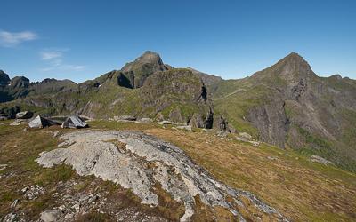
Top of the hill to the foot of Hermanndalstinden (Lofoten - Norway)

Departure: Hill 448m behind the Forsfjorden hydroelectric plant (N67 56.030 E12 58.770)
Arrival: near the lake of Agvatnet (N67 53.211 E12 57.873)
Distance: 13.2 km
Duration of hike: 6 h
Uphill: 794 m
Camping: possible everywhere on the shores of the lake of Ågvatnet
Campsite near the point of arrival: None
Supply point(s): Two small supermarkets in the village of Sørvågen (N67 53.392 E13 01.242 - N67 53.482 E13 01.552) as well as a café/restaurant (Maren Anna - N67 53.376 E13 01.447) on the wharf. There is a little convenience store in the village of Å-i-Lofoten (very expensive! - N67 52.781 E12 59.036) and a café/restaurant near the landing-stage that is open during the high season.
Nearby hikes:Hermandalstinden, Støvla, Tindstinden (Only for registerd users).


Stage No. 11 – Lake of Ågvatnet / Bay of Stokkvika / village of Å-i-Lofoten

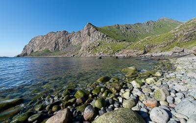
Bay of Stokkvika to the south of the Lofoten Islands (Norway)

Departure: near the lake of Ågvatnet – right bank (N67 53.211 E12 57.873)
Arrival: near the village of Å-i-Lofoten (N67 52.635 E12 58.677)
Distance: 12.5 km
Duration of hike: 6 h
Uphill: 1,117 m
Camping: possible everywhere
Campsite near the point of arrival: None
Supply poi