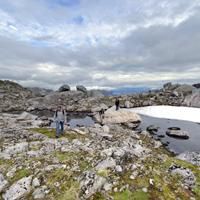
Einangen to Mortsund
Vestvågøya

Difficulty 3
4.8 km
Accessibility : aucune
2-3 H
Forsfjord to Vindstad
Moskenesøya

Difficulty 3
3.3 km
Accessibility : aucune
2-3 H
From Nesland to Nusfjord
Flakstadøya

Difficulty 1
4.9 km
Accessibility : 


3-5 H
From Selfjord to Kjerkfjorden
Moskenesøya

Difficulty 4
9.2 km
Accessibility : 

5-7 H
From Steinetinden to Søreheia
Vestvågøya

Difficulty 4
8.4 km
Accessibility : aucune
3-5 H
From Å i Lofoten to Stokkvika
Moskenesøya

Difficulty 5
13.1 km
Accessibility : aucune
7+ H
Hiking to Andstabben
Moskenesøya

Difficulty 3
5.1 km
Accessibility : aucune
3-5 H
Hiking to Blåfjellkammen (Blåmannen)
Flakstadøya

Difficulty 3
7.4 km
Accessibility : aucune
3-5 H
Hiking to Brunakseltinden
Moskenesøya

Difficulty 3
8 km
Accessibility : aucune
2-3 H
Hiking to Bulitinden and Guratinden
Vestvågøya

Difficulty 3
9.9 km
Accessibility : 


3-5 H
Hiking to Flakstadtinden
Flakstadøya

Difficulty 1
3 km
Accessibility : aucune
2-3 H
Hiking to Geitgallien
Austvågøya

Difficulty 5
10 km
Accessibility : aucune
5-7 H
Hiking to Hellsegga
Moskenesøya

Difficulty 5
6.9 km
Accessibility : aucune
5-7 H
Hiking to Hermanndalstinden
Moskenesøya

Difficulty 5
16.6 km
Accessibility : aucune
7+ H
Hiking to Hermannsdalen
Moskenesøya

Difficulty 3
13.9 km
Accessibility : 

3-5 H
Hiking to Himmeltindan
Vestvågøya

Difficulty 4
7.7 km
Accessibility : aucune
3-5 H
Hiking to Kangerurtinden
Vestvågøya

Difficulty 5
4.9 km
Accessibility : aucune
2-3 H
Hiking to Keiservarden and Snøtinden
Austvågøya

Difficulty 3
9.6 km
Accessibility : 

3-5 H
Hiking to Kongstindan
Austvågøya

Difficulty 3
4.9 km
Accessibility : aucune
2-3 H
Hiking to Merraflestinden
Moskenesøya

Difficulty 3
8.9 km
Accessibility : 

5-7 H
Hiking to Moltinden (Flak)
Flakstadøya

Difficulty 4
4.3 km
Accessibility : aucune
3-5 H
Hiking to Moltinden (Mosk)
Moskenesøya

Difficulty 5
7.2 km
Accessibility : aucune
3-5 H
Hiking to Narvtinden
Moskenesøya

Difficulty 4
7 km
Accessibility : aucune
3-5 H
Hiking to Offersoykammen
Vestvågøya

Difficulty 1
2.5 km
Accessibility : 


2-3 H
Hiking to Reinebringen
Moskenesøya

Difficulty 4
2 km
Accessibility : aucune
2-3 H
Hiking to Rundfjellet
Austvågøya

Difficulty 4
10.1 km
Accessibility : aucune
5-7 H
Hiking to Segltinden
Moskenesøya

Difficulty 5
7.1 km
Accessibility : aucune
5-7 H
Hiking to Store Klauva
Flakstadøya

Difficulty 5
14.4 km
Accessibility : 

5-7 H
Hiking to Stornappstinden
Flakstadøya

Difficulty 3
4.7 km
Accessibility : 

3-5 H
Hiking to Stortinden
Flakstadøya

Difficulty 5
5.4 km
Accessibility : aucune
5-7 H
Hiking to Sundklakktinden and Skjolden
Gimsøya

Difficulty 4
7.4 km
Accessibility : aucune
3-5 H
Hiking to Tindstinden
Moskenesøya

Difficulty 4
5.7 km
Accessibility : aucune
3-5 H
Hiking to Tjeldbergtinden
Austvågøya

Difficulty 1
7.6 km
Accessibility : 


3-5 H
Hiking to Trolldalstinden
Vestvågøya

Difficulty 4
10.4 km
Accessibility : 

3-5 H
Hiking to Trolldalsvatnet
Moskenesøya

Difficulty 1
4.3 km
Accessibility : 


2-3 H
Hiking to Tønsåsheia
Flakstadøya

Difficulty 4
9.4 km
Accessibility : aucune
3-5 H
Hiking to Ulvstinden
Moskenesøya

Difficulty 5
9.6 km
Accessibility : aucune
5-7 H
Hiking to Varden and Stortinden
Austvågøya

Difficulty 4
14.2 km
Accessibility : 

3-5 H
Hiking to Vikjordtinden
Vestvågøya

Difficulty 4
6.9 km
Accessibility : aucune
3-5 H
Hiking to Volandstinden
Flakstadøya

Difficulty 3
6.4 km
Accessibility : 

3-5 H
Hikking to Middagstinden
Vestvågøya

Difficulty 3
8.9 km
Accessibility : aucune
3-5 H
Kabelvag to Olderfjorden
Austvågøya

Difficulty 5
14 km
Accessibility : aucune
5-7 H
Sautinden and Bjørntinden
Flakstadøya

Difficulty 5
7 km
Accessibility : aucune
5-7 H


